Old Town in Alexandria, Virginia — The American South (Mid-Atlantic)
The Nation's Capital Begins Here 1791-1793
Jones Point Park
— National Park Service, U.S. Department of the Interior —
Inscription.
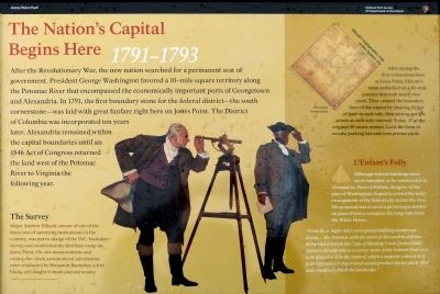
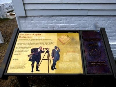
After the Revolutionary War, the new nation searched for a permanent seat of government. President George Washington favored a 10-mile square territory along the Potomac River that encompassed the economically important ports of Georgetown and Alexandria. In 1791, the first boundary stone for the federal district—the south cornerstone—was laid with great fanfare right here on Jones Point. The District of Columbia was incorporated ten years later. Alexandria remained within the capital boundaries until an 1846 Act of Congress returned the land west of the Potomac River to Virginia the following year.
The Survey
Major Andrew Ellicott, owner of one of the finest sets of surveying instruments in the country, was put in charge of the D.C. boundary survey and established the first base camp on Jones Point. On-site measurements and round-the-clock astronomical calculations were conducted by Benjamin Banneker, a free black, self-taught in math and astronomy. Image courtesy of the Maryland Transportation Authority
After laying the first cornerstone here at Jones Point, Ellicott's team embarked on a 40-mile journey that took nearly two years. They created the boundary lines of the capital by clearing 20 feet of land on each side, then setting upright stones at each mile interval. Today 37 of the original 40 stones remain. Look for them in woods, parking lots and even private yards.
L'Enfant's Folly
Although federal buildings were never intended to be constructed in Alexandria, Pierre L'Enfant, designer of the plan of Washington, hoped to extend the axial arrangement of the federal city across the river. His proposal was to erect a picturesque marker on Jones Point to complete the vista from the White House.
"From these hights (sic) every grand building would rear...facing...the Potomac with the town of Alexandria in front...at the end of which the Cape of Hunting Creek [Jones Point] appears directly where a corner stone of the Federal District is to be placed and in the room of which a majestic column or a grand pyramid being erected would produce the happiest effect and completely finish the landscape."
Erected 2012 by National Park Service, U.S. Department of the Interior.
Topics and series. This historical marker is listed in these topic lists: Government & Politics • Man-Made Features. In addition, it is included in the Original Federal Boundary Stones series list. A significant historical date for this entry is April 15, 1791.
Location. 38° 47.423′ N, 77° 2.432′ W. Marker is in Alexandria, Virginia. It is in Old Town. Marker can be reached
from Jones Point Drive east of South Royal Street, on the right when traveling east. On the east side of Jones Point lighthouse. Touch for map. Marker is in this post office area: Alexandria VA 22314, United States of America. Touch for directions.
Other nearby markers. At least 8 other markers are within walking distance of this marker. D.C.'s First Building Block (here, next to this marker); Who Owns the River? (a few steps from this marker); Mistress Margaret Brent (within shouting distance of this marker); The Remarkable Margaret Brent (within shouting distance of this marker); The Jones Point Lighthouse (about 300 feet away, measured in a direct line); The Long Story of The Jones Point Ropewalk (about 400 feet away); Mountains of Materials and Massive Manpower (about 700 feet away); A World War I Shipyard Transforms Jones Point (about 700 feet away). Touch for a list and map of all markers in Alexandria.
Credits. This page was last revised on January 28, 2023. It was originally submitted on October 8, 2012, by Allen C. Browne of Silver Spring, Maryland. This page has been viewed 960 times since then and 34 times this year. Last updated on October 14, 2019, by Roberto Bernate of Arlington, Virginia. Photos: 1, 2, 3. submitted on October 8, 2012, by Allen C. Browne of Silver Spring, Maryland. • Devry Becker Jones was the editor who published this page.


