Kendleton in Fort Bend County, Texas — The American South (West South Central)
Kendleton
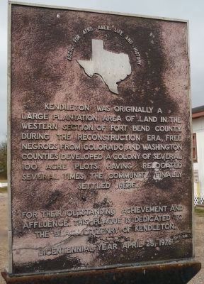
For their outstanding achievement and affluence, the plaque is dedicated to the Black citizenry of Kendleton.
Bicentennial Year, April 25, 1976.
Erected 1976 by the Association for Afro-American Life and History. (Marker Number 9002.)
Topics. This historical marker is listed in these topic lists: African Americans • Agriculture • Notable Places • Settlements & Settlers. A significant historical month for this entry is April 1771.
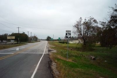
Location. 29° 26.936′ N, 96° 0.056′ W. Marker is in Kendleton, Texas, in Fort Bend County. Marker is on Braxton Street just east of Lum Road (Farm to Market Road 2919), on the right when traveling west. Marker is in the parking lot of the Kendleton City Hall, two blocks north of US Hwy. 59. Touch for map. Marker is in this post office area: Kendleton TX 77451, United States of America. Touch for directions.
Other nearby markers. At least 8 other markers are within 6 miles of this marker, measured as the crow flies. A different marker also named Kendleton (about 500 feet away, measured in a direct line); Terry v. Adams (about 600 feet away); Powell Point School (approx. 2.4 miles away); Site of Quinan Community (approx. 5.7 miles away); J. D. Hudgins Ranch (approx. 5.7 miles away); Site of Post West Bernard Station (approx. 5.7 miles away); New York, Texas & Mexican Railroad and The Community of Hungerford (approx. 5.7 miles away); Beasley (approx. 6 miles away). Touch for a list and map of all markers in Kendleton.
Related markers. Click here for a list of markers that are related to this marker.
Additional keywords. Reconstruction Era
Credits. This page was last revised on June 16, 2016. It was originally submitted on December 4, 2008, by Richard E. Miller of Oxon Hill, Maryland. This page has been viewed 1,612 times since then and 24 times this year. Photos: 1. submitted on December 4, 2008, by Richard E. Miller of Oxon Hill, Maryland. 2, 3, 4. submitted on December 5, 2008, by Richard E. Miller of Oxon Hill, Maryland. • Kevin W. was the editor who published this page.


