Near Manassas in Prince William County, Virginia — The American South (Mid-Atlantic)
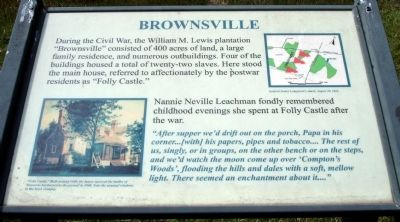
Brownsville
Nannie Neville Leachman fondly remembered childhood evenings she spent at Folly Castle after the war.
“After supper we'd drift out on the porch, Papa in his corner...[with] his papers, pipes and tobacco... The rest of us, singly, or in groups, on the other bench or on the steps, and we'd watch the moon come up over ‘Compton's Woods’, flooding the hills and dales with a soft, mellow light. There seemed an enchantment about it...”
Topics. This historical marker is listed in this topic list: War, US Civil.
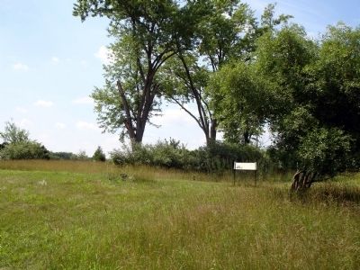
Location. 38° 48.029′ N, 77° 33.086′ W. Marker is near Manassas, Virginia, in Prince William County. Marker can be reached from Pageland Lane. The marker is the southeastern terminus of the Stuart's Hill Loop Trail at Manassas National Battlefield Park. It also a short walk from Pageland Lane. Touch for map. Marker is in this post office area: Manassas VA 20109, United States of America. Touch for directions.
Other nearby markers. At least 8 other markers are within walking distance of this marker. Historic Landscape Restoration (approx. ¼ mile away); Second Battle of Manassas (approx. ¼ mile away); Confederate Counterattack (approx. ¾ mile away); 10th New York Vol. Infantry (approx. ¾ mile away); "The Very Vortex of Hell" (approx. 0.8 miles away); Meadowville (approx. 0.8 miles away); 5th Regiment New York Volunteer Infantry (approx. 0.8 miles away); Battery Heights (approx. 0.8 miles away). Touch for a list and map of all markers in Manassas.
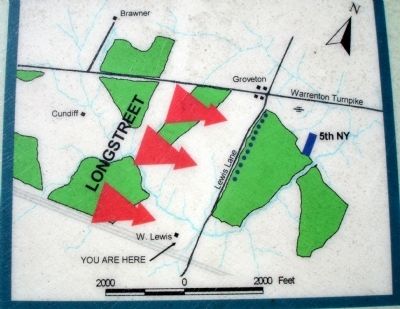
More about this marker. On the lower left of the marker is a painting captioned, “Folly Castle.” Built around 1840, the house survived the battles of Manassas but burned to the ground in 1900. Note the unusual windows in the brick chimney. On the upper right is a map captioned, General James Longstreet's attack, August 30, 1862.
Credits. This page was last revised on June 16, 2016. It was originally submitted on December 6, 2008. This page has been viewed 1,185 times since then and 18 times this year. Photos: 1, 2, 3. submitted on December 6, 2008. • Craig Swain was the editor who published this page.


