Sandusky in Erie County, Ohio — The American Midwest (Great Lakes)
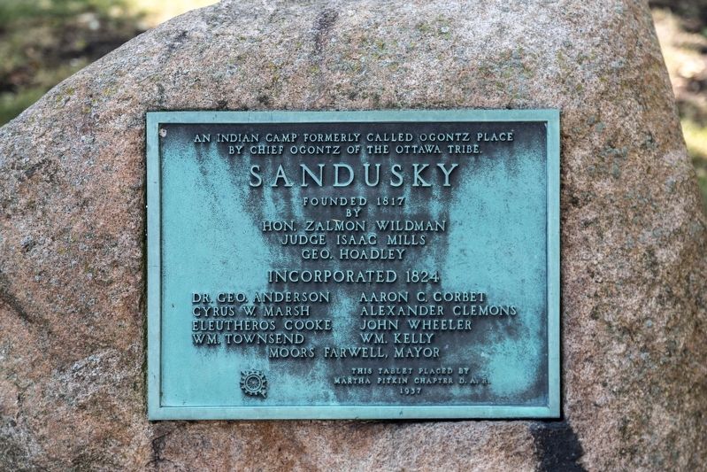
Sandusky
Founded 1817
Erected 1937 by the Martha Pitkin Chapter, D.A.R.
Topics and series. This historical marker is listed in these topic lists: Native Americans • Political Subdivisions • Settlements & Settlers. In addition, it is included in the Daughters of the American Revolution series list. A significant historical year for this entry is 1817.
Location. 41° 27.286′ N, 82° 42.522′ W. Marker is in Sandusky, Ohio, in Erie County. Marker is at the intersection of Huron Avenue (U.S. 6) and Wayne Street, on the right when traveling east on Huron Avenue. It is at Fountain Park. Touch for map. Marker is in this post office area: Sandusky OH 44870, United States of America. Touch for directions.
Other nearby markers. At least 8 other markers are within walking distance of this marker. Grace Episcopal Church (within shouting distance of this marker); Lester S. Hubbard House (about 300 feet away, measured in a direct line); Kilbourne Plat (about 300 feet away); Oran Follett (about 300 feet away); This Concretion (about 300 feet away); Jackson Jr. High School (about 400 feet away); Surrender - World War II (about 500 feet away); John F. Kennedy's Inaugural Address (about 500 feet away). Touch for a list and map of all markers in Sandusky.
Also see . . . Wikipedia entry for Sandusky. Excerpt:
This area was a center of trading and fortifications since the 18th century: the English, French, and Americans had trading posts and forts built on both the north and south sides of Sandusky Bay.(Submitted on October 31, 2019.)
Development by European Americans of the city of Sandusky, starting in 1818, on the southeast shore of Sandusky Bay, followed settlement of the war of 1812. Part of the city quickly enveloped the site of an earlier small village named “Portland” (established about 1816). Eventually the city of Sandusky encompassed most of the entire township that had been called Portland. Some of the city was built on land formerly occupied by a Native-American man named Ogontz, and therefore the city is said to have been built on “Ogontz’ place.”

Photographed By J. J. Prats, August 7, 2019
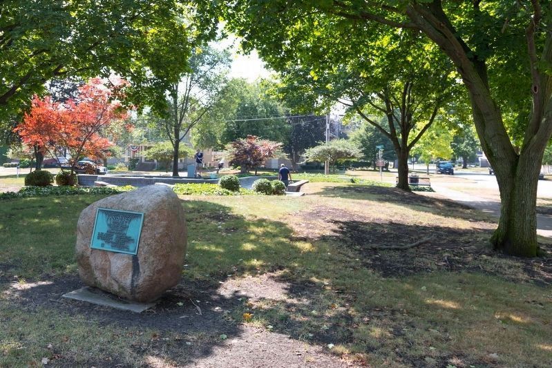
2. Sandusky D.A.R. Monument in Fountain Park
Huron Avenue is behind the photographer. In the distance is the intersection of Wayne Street and East Adams Street and the Follett House Museum. The fountain, directly behind the monument, was being cleaned when this photograph was taken.
Credits. This page was last revised on October 31, 2019. It was originally submitted on October 31, 2019, by J. J. Prats of Powell, Ohio. This page has been viewed 328 times since then and 53 times this year. Photos: 1, 2. submitted on October 31, 2019, by J. J. Prats of Powell, Ohio.
