Near Sandston in Henrico County, Virginia — The American South (Mid-Atlantic)
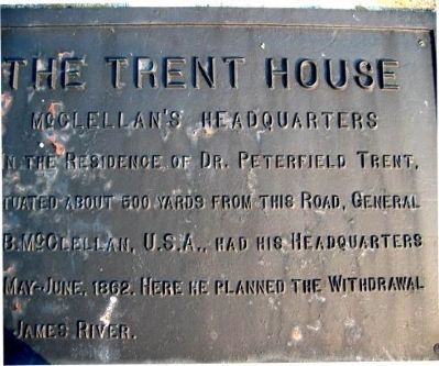
The Trent House
McClellan's Headquarters
Erected by Battlefield Markers Association. (Marker Number 11.)
Topics and series. This historical marker is listed in this topic list: War, US Civil. In addition, it is included in the Freeman Markers (Richmond Battlefields) series list. A significant historical year for this entry is 1862.
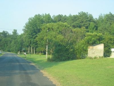
Location. 37° 32.853′ N, 77° 16.717′ W. Marker is near Sandston, Virginia, in Henrico County. Marker is on Old Hanover Road, 0.1 miles west of Grapevine Road, on the left when traveling west. Touch for map. Marker is at or near this postal address: 2410 Old Hanover Rd, Henrico VA 23075, United States of America. Touch for directions.
Other nearby markers. At least 8 other markers are within 2 miles of this marker, measured as the crow flies. A different marker also named The Trent House (approx. 0.3 miles away); Grapevine Bridge (approx. 0.4 miles away); Seven Days Battles (approx. 0.4 miles away); Chickahominy Water Trail (approx. 0.4 miles away); a different marker also named Seven Days Battles (approx. 0.9 miles away); Savage Station (approx. 1.4 miles away); Route to White Oak Swamp and Malvern Hill (approx. 1.4 miles away); Battle of Savage's Station (approx. 1.4 miles away). Touch for a list and map of all markers in Sandston.
Additional keywords. Freeman Markers, Richmond Battlefield Parks Corporation, Douglas Southall Freeman
Credits. This page was last revised on November 5, 2021. It was originally submitted on December 7, 2008, by Bernard Fisher of Richmond, Virginia. This page has been viewed 1,531 times since then and 40 times this year. Photos: 1, 2. submitted on December 7, 2008, by Bernard Fisher of Richmond, Virginia. • Craig Swain was the editor who published this page.

