Fort Benton in Chouteau County, Montana — The American West (Mountains)
Stream Flow Monitoring
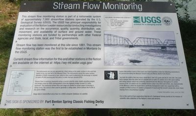
Stream flow had been monitored at this site since 1881. This stream flow monitoring station was the first to be established in Montana by the USGS. Current stream flow information for this and other states in the Nation are available on the internet at http://wy-mt.water.usgs.gov/
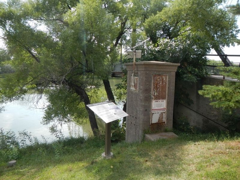
The instruments you see are operated by a float riding on the water surface in the well that reacts to the rise and fall of the Missouri River. The instruments record the water surface elevation (STAGE) measured in feet, which is then used to determine the discharge or volume of water (FLOW) passing this point in cubic feet per second (CFS).
Steam flow is routinely measured using a current velocity meter, depth-sounding weight, and bridge crane by USGS hydrographers from the highway bridge located 0.e miles upstream. The measured stream flow and stage are plotted on graph paper to develop a rating curve. The curve is then used to generate a rating table which defines the FLOW at any given STAGE.
Stage data is transmitted every hour to a USGS computer database via satellite.
Captain Meriwether Lewis of the Lewis and Clark Expedition made the following comments in his journal describing the Missouri (South Fork) and Marias (North Fork) Rivers.
"we took the width of the two rivers, found the S. fork 372 yards and the N. fork 200. The north fork is deeper than the other but it's courant not so swift; it's waters run in the same boiling and roling manner which has uniformly characterized the Missouri throughout it's whole course so far; its waters are of a whitish brown colour very thick and tebid, also characteristic of the Missouri; while the South fork is perfectly transparent runs very rappid but with a smooth unriffled surface its's bottom composed of round and flat stones like most rivers issuing from a mountainous country. -- Captain Meriwether Lewis, June 3. 1805
It is in this spirit of river exploration that the U.S. Geological Survey carries on its mission of scientific data collection of the Nation's rivers and streams.
Erected by Fort Benton Community Improvement Association.
Topics and series. This historical marker is listed in these topic lists: Exploration • Science & Medicine • Waterways & Vessels. In addition, it is included in the Lewis & Clark Expedition series list. A significant historical date for this entry is June 3, 1805.
Location. 47° 49.046′ N, 110° 40.023′ W. Marker is in Fort Benton, Montana, in Chouteau County. Marker is on Front Street near 15th Street, on the right when traveling east. Touch for map. Marker is in this post office area: Fort Benton MT 59442, United States of America. Touch for directions.
Other nearby markers. At least 8 other markers are within walking distance of this marker. June 6, 1908 (here, next to this marker); "George Montgomery: Rider of the Purple Sage" (here, next to this marker); Open Range Cattle (a few steps from this marker); Culbertson House (a few steps from this marker); Fort Benton Bridge (a few steps from this marker); Old Fort Benton Bridge (within shouting distance of this marker); First Fire Engine House (within shouting distance of this marker); Fort Benton Engine House (within shouting distance of this marker). Touch for a list and map of all markers in Fort Benton.
More about this marker. This marker is located in Fort Benton's riverside park.
Credits. This page was last revised on November 9, 2019. It was originally submitted on November 9, 2019, by Barry Swackhamer of Brentwood, California. This page has been viewed 146 times since then and 14 times this year. Photos: 1, 2. submitted on November 9, 2019, by Barry Swackhamer of Brentwood, California.

