Near Richmond in Chesterfield County, Virginia — The American South (Mid-Atlantic)
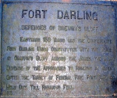
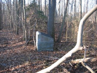
Fort Darling
Defences of Drewry's Bluff
Erected by Battlefield Markers Association. (Marker Number 59.)
Topics and series. This historical marker is listed in these topic lists: Forts and Castles • War, US Civil. In addition, it is included in the Freeman Markers (Richmond Battlefields) series list.
Location. 37° 25.356′ N, 77° 25.408′ W. Marker is near Richmond, Virginia, in Chesterfield County. Marker can be reached from Fort Darling Road. Located within the Drewry's Bluff (Fort Darling) unit of the Richmond National Battlefield Park. Touch for map. Marker is at or near this postal address: 7600 Fort Darling Road, Richmond VA 23237, United States of America. Touch for directions.
Other nearby markers. At least 8 other markers are within walking distance of this marker. A Permanent Post (a few steps from this marker); Camp Beall (within shouting distance of this marker); The First Marine Medal of Honor (within shouting distance of this marker); "A Very Neat Chapel" (about 300 feet away, measured in a direct line); Hot Shot and Wooden Ships (about 500 feet away); Covered Way (about 500 feet away); A Perfect Gibraltar (about 500 feet away); The USS Monitor (about 500 feet away). Touch for a list and map of all markers in Richmond.
Also see . . .
1. Drewry’s Bluff. Richmond National Battlefield Park (Submitted on October 18, 2010, by Bernard Fisher of Richmond, Virginia.)
2. Drewry’s Bluff. Civil War Richmond (Submitted on May 14, 2012, by Bernard Fisher of Richmond, Virginia.)
Additional keywords. Freeman Markers, Richmond Battlefield Parks Corporation, Douglas Southall Freeman

Photographed By Shane Oliver, October 22, 2016
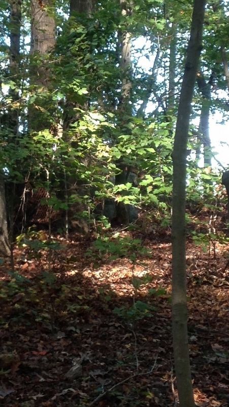
3. Fort Darling Marker Can Be Seen Underneath The Trees
Look closely underneath the trees, a concrete base is visible. This is the location of the "Fort Darling" Freeman Marker. However,a chain-link fence is located a few yards in front of the marker, (not photographed) preventing public access. This is the closest you can get to the marker, as it is no longer accessible to the public.
Credits. This page was last revised on February 20, 2017. It was originally submitted on December 8, 2008, by Bernard Fisher of Richmond, Virginia. This page has been viewed 1,765 times since then and 44 times this year. Photos: 1, 2. submitted on December 8, 2008, by Bernard Fisher of Richmond, Virginia. 3. submitted on February 18, 2017, by Shane Oliver of Richmond, Virginia. 4. submitted on May 14, 2012, by Bernard Fisher of Richmond, Virginia. • Craig Swain was the editor who published this page.


