Near Richmond in Henrico County, Virginia — The American South (Mid-Atlantic)
Freeman Marker
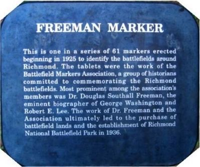
This is one in a series of 61 markers erected beginning in 1925 to identify the battlefields around Richmond. The tablets were the work of the Battlefield Markers Association, a group of historians committed to commemorating the Richmond battlefields. Most prominent among the association's members was Dr. Douglas Southall Freeman, the eminent biographer of George Washington and Robert E. Lee. The work of Dr. Freeman and the Association ultimately led to the purchase of battlefield lands and the establishment of Richmond National Battlefield Park in 1936.
Topics. This historical marker is listed in these topic lists: Parks & Recreational Areas • War, US Civil. A significant historical year for this entry is 1925.
Location. 37° 24.798′ N, 77° 15.206′ W. Marker is near Richmond, Virginia, in Henrico County. Marker can be reached from Willis Church Road, on the right when traveling south. Located along the walking trail west of the Crew House within the Malvern Hill unit of the Richmond National Battlefield Park. Touch for map. Marker is at or near this postal address: 9170 Willis Church Rd, Henrico VA 23231, United States of America. Touch for directions.
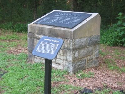
Other nearby markers. At least 8 other markers are within walking distance of this marker. Malvern Hill (here, next to this marker); Malvern Cliffs (within shouting distance of this marker); The Crew House (about 300 feet away, measured in a direct line); A Place of Refuge (about 400 feet away); Advantages of Terrain (about 400 feet away); a different marker also named Malvern Cliffs (about 400 feet away); “the grandest sean of all” (about 500 feet away); The Malvern Hill Crest (about 500 feet away). Touch for a list and map of all markers in Richmond.
Also see . . .
1. Freeman Markers. Website homepage:
More information about the markers. (Submitted on December 8, 2008.)
2. Freeman Markers listed in HMDB. (Submitted on December 8, 2008, by Craig Swain of Leesburg, Virginia.)

2. Malvern Hill - CWPT
Civil War Preservation Trust's efforts to preserve portions of the battlefield.
Click for more information.
Click for more information.
Credits. This page was last revised on April 11, 2024. It was originally submitted on December 8, 2008, by Bernard Fisher of Richmond, Virginia. This page has been viewed 1,216 times since then and 31 times this year. Photos: 1. submitted on December 8, 2008, by Bernard Fisher of Richmond, Virginia. 2. submitted on March 28, 2010, by Craig Swain of Leesburg, Virginia. 3. submitted on December 8, 2008, by Bernard Fisher of Richmond, Virginia. • Craig Swain was the editor who published this page.

