Lorentz in Upshur County, West Virginia — The American South (Appalachia)
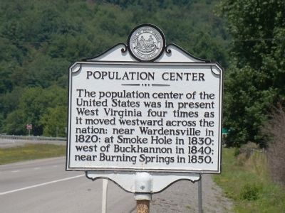
Population Center
Erected by West Virginia Archives and History.
Topics and series. This historical marker is listed in this topic list: Notable Places. In addition, it is included in the West Virginia Archives and History series list. A significant historical year for this entry is 1820.
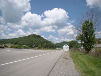
Location. 39° 0.642′ N, 80° 18.117′ W. Marker is in Lorentz, West Virginia, in Upshur County. Marker is at the intersection of U.S. 33 and County Highway 5/1, on the right when traveling west on U.S. 33. Touch for map. Marker is in this post office area: Lorentz WV 26229, United States of America. Touch for directions.
Other nearby markers. At least 8 other markers are within 4 miles of this marker, measured as the crow flies. Lorentz (approx. ¼ mile away); The Bassel House (approx. 2.7 miles away); The History Center (approx. 3.9 miles away); In Tribute to and in Memory of Buckhannon Volunteer Fire Department, Inc. (approx. 4 miles away); Buckhannon / Frontier Days (approx. 4 miles away); Operation Desert Storm Memorial (approx. 4 miles away); Destruction at the Courthouse (approx. 4 miles away); Veterans Memorial (approx. 4 miles away).
Related marker. Click here for another marker that is related to this marker.
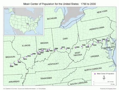
Also see . . . Centers of Population. If the United States map were perfectly balanced on a point, this point would be its physical centroid. Currently this point is located in Phelps County, Missouri, in the east-central part of the state. However, when Washington, D.C. was chosen as the federal capital of the United States in 1790, the center of the U.S. population was in Kent County, Maryland, a mere 47 miles (76 km) east-northeast of the new capital. Over the last two centuries, the mean center of United States population has progressed westward and, since 1930, southwesterly, reflecting population drift. (Submitted on December 14, 2008.)
Credits. This page was last revised on June 9, 2020. It was originally submitted on December 14, 2008, by J. J. Prats of Powell, Ohio. This page has been viewed 1,042 times since then and 31 times this year. Photos: 1, 2, 3. submitted on December 14, 2008, by J. J. Prats of Powell, Ohio.


