Near Fredericksburg in Stafford County, Virginia — The American South (Mid-Atlantic)
The Washington Plantation
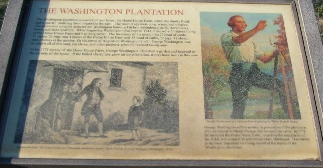
In his 1771 survey of the Home House Farm, George Washington identified a garden and henyard in the vicinity of the house. If the fabled cherry tree grew on the plantation, it may have been in this area.
George Washington left his mother in possession of the plantation after he moved to Mount Vernon, but returned for visits. In 1771 he surveyed the Home House Farm, recording the boundaries of the fields and pastures he had known since childhood. This survey is the most important surviving record of the layout of the Washington plantation.
Topics and series. This historical marker is listed in these topic lists: African Americans • Agriculture • Colonial Era • Settlements & Settlers. In addition, it is included in the Former U.S. Presidents: #01 George Washington series list. A significant historical year for this entry is 1743.
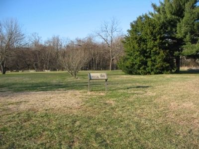
Location. Marker has been reported missing. It was located near 38° 17.735′ N, 77° 26.974′ W. Marker was near Fredericksburg, Virginia, in Stafford County. Marker could be reached from Kings Highway (State Highway 3), on the right when traveling south. Located on the walking trail for the Washington's Boyhood Home site. Touch for map. Marker was at or near this postal address: 240 Kings Hwy, Fredericksburg VA 22405, United States of America. Touch for directions.
Other nearby markers. At least 8 other markers are within walking distance of this location. Enslaved Quarter (a few steps from this marker); Root Cellar (within shouting distance of this marker); George Washington Boyhood Home Site (about 800 feet away, measured in a direct line); George Washington’s Childhood Home (about 800 feet away); Creek Delegation in Fredericksburg (approx. 0.2 miles away); Fredericksburg's Wharves and Harbor (approx. 0.2 miles away); George Washington’s Boyhood Home at Ferry Farm (approx. 0.2 miles away); Fredericksburg City Dock (approx. ¼ mile away). Touch for a list and map of all markers in Fredericksburg.
More about this marker. In the lower left of the marker is a drawing, published in Anna C. Reed's The Life of George Washington from 1842, depicting the famous cherry tree incident. On the right is a depiction of George Washington as a surveyor from by Walter Haskell Hinton.
Also see . . . Archeologists Discover Historical Gem. Excavations at Washington’s Boyhood Home Uncover Vital Piece of Presidential History. (Submitted on December 15, 2008, by Craig Swain of Leesburg, Virginia.)

Photographed By Craig Swain, December 13, 2008
3. Ongoing Excavations around the House Foundation
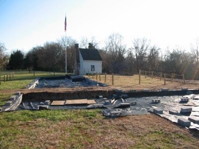
In the summer of 2008 archeologists announced the discovery of Washington's boyhood home. The home had burned in a 1740 Christmas Eve fire. The white building behind the dig sites is the Surveyor's Shed, which dates to 1870.
Credits. This page was last revised on April 28, 2023. It was originally submitted on December 15, 2008, by Craig Swain of Leesburg, Virginia. This page has been viewed 1,010 times since then and 17 times this year. Photos: 1, 2, 3. submitted on December 15, 2008, by Craig Swain of Leesburg, Virginia.

