Petersburg in Grant County, West Virginia — The American South (Appalachia)
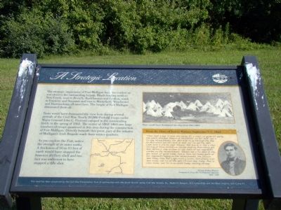
A Strategic Location
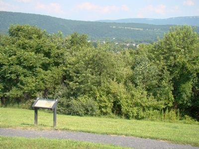
Tents would have dominated the view here during several periods of the Civil War. Nearly 20,000 Federal troops under Major General John C. Fremont camped in the surrounding fields in the spring of 1862. The winter of 1863-1864 saw large numbers of troops quartered in this area during the construction of Fort Mulligan. Directly beneath this point, part of the infantry of Mulligan’s Irish Brigade made their winter quarters.
As you explore the Fort, notice the strength of its outer works. A thickness of 10 to 15 feet of earth would have stopped the heaviest artillery shell and two feet was sufficient to have stopped a rifle shot.
From the Diary of Joshua Winters, September 3–7, 1863.
“Thur Sept 3 1863. it raind this eaving. Fri 4. clear. all quiet till eaving. the rebels attacked Stevens at Moorefield. we fell back. our 4 Co dug intrenchments. the 29th tride to go through the Gap to Moorefield but fell back at dark. our Co and the 29th went back 12 mile to meet Stevens. Met him at 12. Sat 5. this morning at three oclock we started back to Petersburg, got hear before 8. lade in camp all day. both of our regements worked on the intrenchments. Stevens and 5 Co staid at the gun stock. all quiet today. Sun 6. Sum rain today. both of ourregements digging on the intrenchments. the 54 com hear today. thay had a squrmish a comin. Sum Cavery com hear today. one Co of the 10th VA com hear today. Mon 7. clear today. our Co is on pickit today. nuthing strange.”
Erected by Civil War Preservation Trust.
Topics. This historical marker is listed in this topic list: War, US Civil. A significant historical date for this entry is September 3, 1855.
Location. 39° 0.017′ N, 79° 8.333′ W. Marker is in Petersburg, West Virginia, in Grant County. Marker can be reached from Grant Memorial Hospital Parking south of West Virginia Route 55. Touch for map. Marker is in this post office area: Petersburg WV 26847, United States of America. Touch for directions.
Other nearby markers. At least 8 other markers are within walking distance of this marker. Civil War Cannons (within shouting distance of this marker); Protecting Supplies (about 300 feet away, measured in a direct line); Parrott Rifle (about 300 feet away); Defending the Fort (about 300 feet away); The Last Days of Fort Mulligan (about 300 feet away); The Irish Brigade & the McNeill Rangers / The Civil War Comes to Hardy County (about 400 feet away); Welcome to Fort Mulligan Civil War Site (about 400 feet away); Winter Quarters Huts (about 600 feet away). Touch for a list and map of all markers in Petersburg.
More about this marker. On the lower right is a portrait of “Private Joshua Winters, First (W) VA Volunteer Infantry (1843–1900).”
Credits. This page was last revised on December 17, 2020. It was originally submitted on December 21, 2008, by J. J. Prats of Powell, Ohio. This page has been viewed 1,549 times since then and 15 times this year. Photos: 1. submitted on December 21, 2008, by J. J. Prats of Powell, Ohio. 2. submitted on December 17, 2020, by Shane Oliver of Richmond, Virginia. 3. submitted on December 21, 2008, by J. J. Prats of Powell, Ohio. • Craig Swain was the editor who published this page.


