Pickadat Corner in Chesterfield County, Virginia — The American South (Mid-Atlantic)
Swift Creek Battlefield: A Landscape of Change
Inscription.
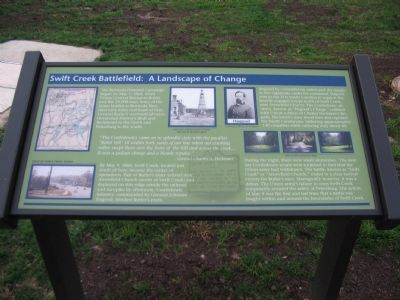
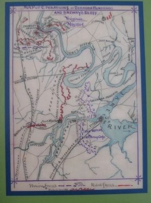
The Bermuda Hundred Campaign began on May 5, 1864, when Union General Benjamin Butler and the 33,000-man Army of the James landed at Bermuda Hundred nine miles northeast of here. General Butler's westward advance threatened Drewry's Bluff and Richmond to the north and Petersburg to the south.
"The Confederates came on in splendid style with the peculiar "Rebel Yell" till within forty yards of our line when our crushing volley swept them over the brow of the hill and across the creek....It was a gallant charge and a bloody repulse."
-General Charles A. Heckman
By May 9, 1864, Swift Creek, located just south of here, became the center of operations. Part of Butler's army arrived near Arrowfield Church (north of Swift Creek) and deployed on this ridge astride the railroad and turnpike by afternoon. Confederate infantry, commanded by General Johnson Hagood, blocked Butler's route.
Angered by contradictory orders and the danger to two regiments under his command, Hagood sent in the 21st South Carolina to support the heavily engaged troops north of Swift Creek, near Arrowfield Church. The Confederate advance, known as "Hagood's Charge," collided with Union soldiers of Charles Heckman's Brigade. Heckman's men stood firm and repulsed the South Carolinians, inflicting approximately 140 casualties while suffering only about 60.
During the night, there were small skirmishes. The next day Confederate scouts were surprised to find that the Union army had withdrawn. The battle, known as "Swift Creek" or "Arrowfield Church," ended in a clear tactical victory for Butler's men. Strategically however, it was a defeat. The Union army's failure to cross Swift Creek temporarily ensured the safety of Petersburg. The action of May 9 was the first and last time that a battle was fought within and around the boundaries of Swift Creek.
Topics. This historical marker is listed in this topic list: War, US Civil. A significant historical date for this entry is May 5, 1864.
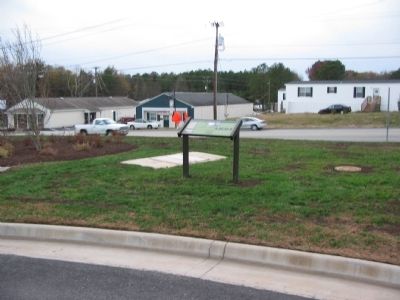
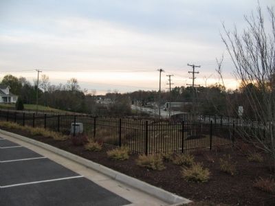
Location. 37° 17.211′ N, 77° 24.679′ W. Marker is in Pickadat Corner, Virginia, in Chesterfield County. Marker can be reached from Jefferson Davis Highway (U.S. 1 / 301), on the right when traveling north. Located in a parking lot to the east side of the highway. Touch for map. Marker is in this post office area: Colonial Heights VA 23834, United States of America. Touch for directions.
Other nearby markers. At least 8 other markers are within 2 miles of this marker, measured as the crow flies. Union Army Checked (within shouting distance of this marker); Battle of Swift Creek (approx. ¼ mile away); "Brave to Madness" (approx. 0.3 miles away); Electric Railway (approx. half a mile away); Redwater Creek Engagement (approx. 0.7 miles away); Union Army Railroad Raids (approx. 0.7 miles away); Advance on Petersburg (approx. ¾ mile away); Ellerslie (approx. 1.2 miles away). Touch for a list and map of all markers in Pickadat Corner.
More about this marker. A wartime map of the Confederate defenses of Bermuda Hundred appears in the upper left. In the lower left is a photo of Swift Creek today looking south down Jefferson Davis Highway (the wartime Richmond Turnpike). In the upper center is a wartime photo of a Union signal tower erected by Butler's army and a portrait of General Hagood. On the right are three photos showing views of the battlefield in 2005.
Credits. This page was last revised on June 16, 2016. It was originally submitted on December 24, 2008, by Craig Swain of Leesburg, Virginia. This page has been viewed 1,877 times since then and 56 times this year. Photos: 1, 2, 3, 4. submitted on December 24, 2008, by Craig Swain of Leesburg, Virginia.


