Marker Logo HMdb.org THE HISTORICAL
MARKER DATABASE
“Bite-Size Bits of Local, National, and Global History”
Eureka in Eureka County, Nevada — The American Mountains (Southwest)
 

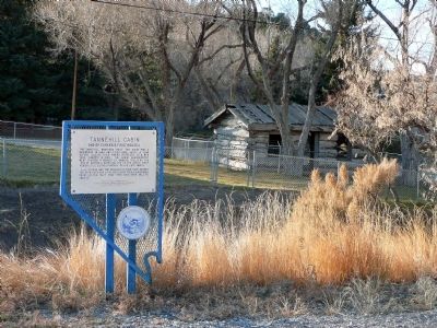
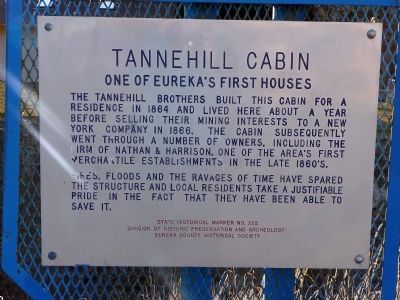
Tannehill Cabin

One of Eureka's First Houses


Tannehill Cabin Marker image. Click for full size.
Photographed By Karen Key, November 23, 2008
1. Tannehill Cabin Marker
Inscription.
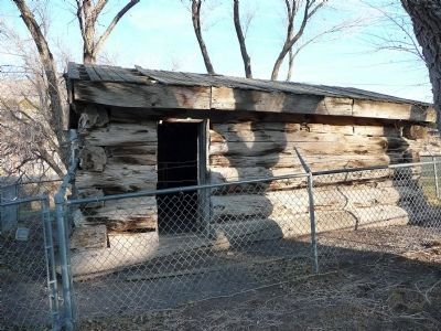
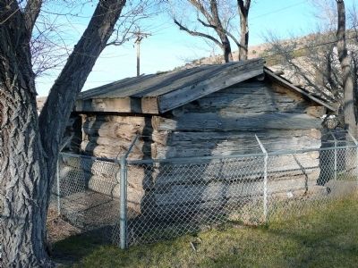
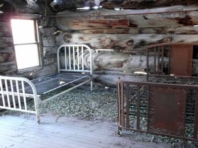
The Tannehill brothers built this cabin for a residence in 1864 and lived here about a year before selling their mining interest to a New York company in 1866. The cabin subsequently went through a number of owners, including the firm of Nathan & Harrison, one of the area's first mercantile establishments in the late 1860's.

Fires, floods and the ravages of time have spared the structure and local residents take a justifiable pride in the fact that they have been able to save it.
 
Erected by Division of Historic Preservation and Archeology and Eureka County Historical Society. (Marker Number 222.)
 
Topics. This historical marker is listed in these topic lists: Industry & CommerceSettlements & Settlers. A significant historical year for this entry is 1864.
 
Location. 39° 30.2′ N, 115° 57.567′ W. Marker is in Eureka, Nevada, in Eureka County. Marker is at the intersection of Highway 50 and Tan Hill Road, on the right when traveling east on Highway 50. Touch for map. Marker is in this post office area: Eureka NV 89316, United States of America. Touch for directions.
 
Other nearby markers. At least 8 other markers are within walking distance of this marker. Eureka (approx. ¼ mile away); Eureka Opera House (approx. 0.6 miles away); Eureka Courthouse (approx. 0.6 miles away); Eureka Sentinel Building (approx.

Paid Advertisement
Click on the ad for more information.
Please report objectionable advertising to the Editor.
Click or scan to see
this page online
0.6 miles away); Eureka Sentinel Newspaper (approx. 0.6 miles away); Eureka & Palisade RR (approx. 0.7 miles away); Bartine Outhouse (approx. 0.7 miles away); Charcoal Burners Massacred Aug. 18, 1879 (approx. ¾ mile away). Touch for a list and map of all markers in Eureka.
 
Tannehill Cabin Marker image. Click for full size.
Photographed By Karen Key, November 23, 2008
2. Tannehill Cabin Marker
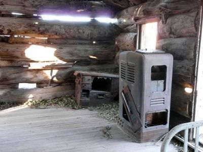
Tannehill Cabin image. Click for full size.
Photographed By Karen Key, November 23, 2008
3. Tannehill Cabin
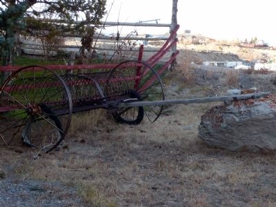
Tannehill Cabin image. Click for full size.
Photographed By Karen Key, November 23, 2008
4. Tannehill Cabin
Tannehill Cabin image. Click for full size.
Photographed By Karen Key, November 23, 2008
5. Tannehill Cabin
Tannehill Cabin image. Click for full size.
Photographed By Karen Key, November 23, 2008
6. Tannehill Cabin
Tannehill Cabin image. Click for full size.
Photographed By Karen Key, November 23, 2008
7. Tannehill Cabin
 
 
Credits. This page was last revised on December 22, 2020. It was originally submitted on December 25, 2008, by Karen Key of Sacramento, California. This page has been viewed 1,336 times since then and 36 times this year. Photos:   1, 2, 3, 4, 5, 6, 7. submitted on December 25, 2008, by Karen Key of Sacramento, California.
Share this page.  
Share on Tumblr
m=14688

CeraNet Cloud Computing sponsors the Historical Marker Database.
This website earns income from purchases you make after using our links to Amazon.com. We appreciate your support.
Paid Advertisement
Apr. 24, 2024