Barwick in Thomas County, Georgia — The American South (South Atlantic)
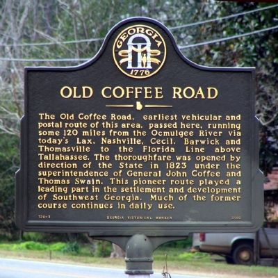
Old Coffee Road
Erected 2000 by Georgia Department of Natural Resources. (Marker Number 136-3.)
Topics and series. This historical marker is listed in these topic lists: Communications • Roads & Vehicles • Settlements & Settlers. In addition, it is included in the Georgia Historical Society, and the Postal Mail and Philately series lists. A significant historical year for this entry is 1823.
Location. 30° 53.4′ N, 83° 44.45′ W. Marker is in Barwick, Georgia, in Thomas County. Marker is at the intersection of Cedar Street (Georgia Route 33) and Coffee Road, on the right when traveling north on Cedar Street. Touch for map. Marker is in this post office area: Barwick GA 31720, United States of America. Touch for directions.
Other nearby markers. At least 8 other markers are within 13 miles of this marker, measured as the crow flies. Bethel Primitive Baptist Church (approx. 8.8 miles away); a different marker also named Old Coffee Road (approx. 9.8 miles away); Liberty Baptist Church (approx. 11.6 miles away); Grooverville Methodist Church (approx. 11.6 miles away); Bethlehem Primitive Baptist Church (approx. 11.9 miles away); West End Cemetery (approx. 12.6 miles away); Quitman Veterans Memorial (approx. 12.9 miles away); Brooks County (approx. 13 miles away).
Related markers. Click here for a list of markers that are related to this marker. Tracing the route of the Old Coffee Road.
Credits. This page was last revised on February 1, 2020. It was originally submitted on December 28, 2008, by David Seibert of Sandy Springs, Georgia. This page has been viewed 1,083 times since then and 11 times this year. Photo 1. submitted on December 28, 2008, by David Seibert of Sandy Springs, Georgia. • Kevin W. was the editor who published this page.
Editor’s want-list for this marker. A wide shot of the marker and its surroundings. • Can you help?
