Cumberland Township near Round Top in Adams County, Pennsylvania — The American Northeast (Mid-Atlantic)
Third Brigade
First Division - Fifth Corps
— Army of the Potomac —
Inscription.
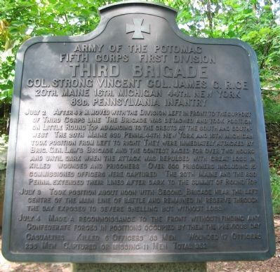
Fifth Corps First Division
Third Brigade
Col. Strong Vincent, Col. James C. Rice
20th. Maine, 16th. Michigan, 44th. New York
83d. Pennsylvania Infantry
July 3 Took position about noon with Second Brigade near the left centre of the main line of battle and remained in reserve through the day exposed to severe shelling but without loss.
July 4 Made a reconnoissance to the front without finding any Confederate forces in positions occupied by them the previous day.
Casualties. Killed 6 Officers 83 Men. Wounded 17 Officers 236 Men. Captured or missing 11 men. Total 353.
Erected 1912 by Gettysburg National Military Park Commission.
Topics. This historical marker is listed in this topic list: War, US Civil. A significant historical date for this entry is July 2, 1883.
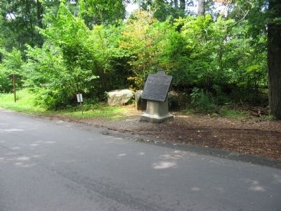
Location. 39° 47.449′ N, 77° 14.199′ W. Marker is near Round Top, Pennsylvania, in Adams County. It is in Cumberland Township. Marker is on Sykes Avenue, on the left when traveling north. Located at stop 8, Little Round Top, on the driving tour of Gettysburg National Military Park. Touch for map. Marker is in this post office area: Gettysburg PA 17325, United States of America. Touch for directions.
Other nearby markers. At least 8 other markers are within walking distance of this marker. "Hold The Ground At All Hazards" (a few steps from this marker); Gen. Strong Vincent (within shouting distance of this marker); The Tenacious 20th Maine (within shouting distance of this marker); Historic Breastworks (within shouting distance of this marker); 12th and 44th New York Infantry (within shouting distance of this marker); Col. Strong Vincent (within shouting distance of this marker); 83rd Pennsylvania Infantry (within shouting distance of this marker); 140th New York Infantry (within shouting distance of this marker). Touch for a list and map of all markers in Round Top.
Also see . . . Reports of Col. James C. Rice. Col. James Rice, 44th New York assumed command after Vincent was mortally wounded. Of the desperate fighting on Little Round Top, Rice wrote:
To effect this object the enemy made every effort. Massing two or three brigades of his force, he tried for an hour in vain to break the lines of the Forty-fourth New York and Eighty-third Pennsylvania, charging again and again within a few yards of these unflinching troops. At every charge he was repulsed with terrible slaughter. Despairing of success at this point, he made a desperate attack upon the extreme right of the brigade, forcing back a part of the Sixteenth Michigan. This regiment was broken, and, through some misunderstanding of orders, explained in the official report of the commanding officer, it was thrown into confusion; but being immediately supported by the One hundred and fortieth New York Volunteers, the line became again firm and unbroken.
Rice included a map of the position in his report. (Submitted on January 2, 2009, by Craig Swain of Leesburg, Virginia.)

Photographed By Craig Swain, July 24, 2008
3. South-West Side of Little Round Top
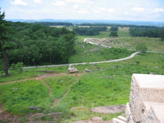
Looking from the 14th / 44th New York Monument at the south crest of Little Round Top. In the distance where Warren Avenue intersects Sickles Avenue is the Devil's Den. Vincent's Brigade arrived on this side of Little Round Top just as elements of Law's and Robertson's Confederate Brigades began ascending the slopes here. Some of the most difficult fighting occurred in this open area. The stone walls are breastworks erected by the Federals during and after the fighting. The 16th Michigan Infantry monument along the breastworks indicates a position held after the repulse of the Confederate attack. The distance to the Devil's Den from this point is just over 300 yards.
Credits. This page was last revised on February 7, 2023. It was originally submitted on January 2, 2009, by Craig Swain of Leesburg, Virginia. This page has been viewed 1,076 times since then and 10 times this year. Photos: 1, 2, 3. submitted on January 2, 2009, by Craig Swain of Leesburg, Virginia.

