Blackshear in Pierce County, Georgia — The American South (South Atlantic)
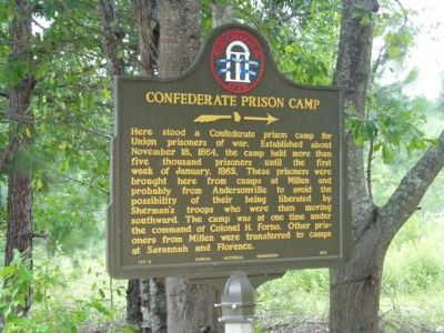
Confederate Prison Camp
Erected 1956 by Georgia Historical Commission. (Marker Number 113-2.)
Topics and series. This historical marker is listed in these topic lists: Cemeteries & Burial Sites • War, US Civil. In addition, it is included in the Georgia Historical Society series list. A significant historical month for this entry is January 1865.
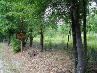
Location. 31° 18.963′ N, 82° 14.962′ W. Marker is in Blackshear, Georgia, in Pierce County. Marker is on Blackshear Highway (Georgia Route 203) west of Moore Street, on the right when traveling west. Located approximately ¼ of a mile southwest of Blackshear Elementary School. Marker is near Confederate Road. Touch for map. Marker is in this post office area: Blackshear GA 31516, United States of America. Touch for directions.
Other nearby markers. At least 5 other markers are within 10 miles of this marker , measured as the crow flies. Pierce County (approx. ¾ mile away); General Blackshear's Military Road (approx. 0.9 miles away); Okefenokee Swamp (approx. 9.2 miles away); Ware Court House (approx. 9.4 miles away); Nancy Hart Highway (approx. 9.4 miles away). Touch for a list and map of all markers in Blackshear.
Credits. This page was last revised on June 16, 2016. It was originally submitted on July 2, 2007, by John Walker Guss of Hillsborough, North Carolina. This page has been viewed 3,779 times since then and 168 times this year. Photos: 1, 2. submitted on July 2, 2007, by John Walker Guss of Hillsborough, North Carolina. • J. J. Prats was the editor who published this page.

