Almaden in San Jose in Santa Clara County, California — The American West (Pacific Coastal)
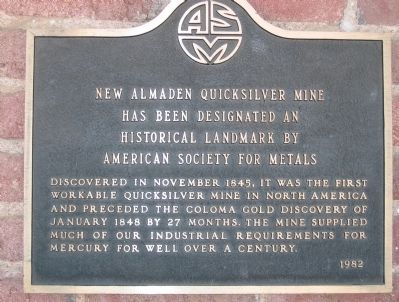
New Almaden Quicksilver Mine
Erected 1982.
Topics and series. This historical marker is listed in these topic lists: Landmarks • Natural Resources • Notable Places • Settlements & Settlers. In addition, it is included in the ASM International Historical Landmarks series list. A significant historical year for this entry is 1845.
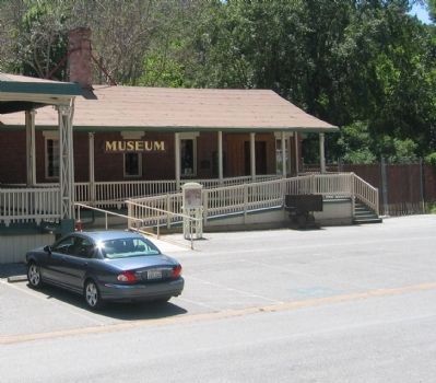
Location. 37° 10.703′ N, 121° 49.172′ W. Marker is in San Jose, California, in Santa Clara County. It is in Almaden. Marker is mounted at the entrance to the Mining Museum at Casa Grande. Touch for map. Marker is at or near this postal address: 21350 Almaden Road, San Jose CA 95120, United States of America. Touch for directions.
Other nearby markers. At least 8 other markers are within walking distance of this marker. Casa Grande (within shouting distance of this marker); The Randol Family Home (about 300 feet away, measured in a direct line); Hacienda Cemetery (about 400 feet away); John Young House (about 400 feet away); a different marker also named Hacienda Cemetery (about 400 feet away); Huttner House (about 500 feet away); Robert Scott House (about 600 feet away); New Almaden (about 600 feet away). Touch for a list and map of all markers in San Jose.
Regarding New Almaden Quicksilver Mine. Also see all other New Almaden Quicksilver Mine “Nearby Markers” for additional information.
Also see . . .
1. Timeline detailing the events of New Almaden Mine from 1824 to 2009. (Submitted on January 4, 2009, by Syd Whittle of Mesa, Arizona.)
2. Santa Clara County Parks – The New Almaden Mine Museum. (Submitted on January 4, 2009, by Syd Whittle of Mesa, Arizona.)
Credits. This page was last revised on February 7, 2023. It was originally submitted on January 4, 2009, by Syd Whittle of Mesa, Arizona. This page has been viewed 1,250 times since then and 27 times this year. Photos: 1, 2, 3, 4. submitted on January 4, 2009, by Syd Whittle of Mesa, Arizona.


