Cumberland Township near Gettysburg in Adams County, Pennsylvania — The American Northeast (Mid-Atlantic)
Anderson's Brigade
Hood's Division - Longstreet's Corps
— Army of Northern Virginia —
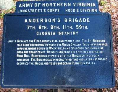
Longstreet's Corps Hood's Division
Anderson's Brigade
7th. 8th. 9th. 11th. 59th.
Georgia Infantry
July 2 Reached the Field about 4 p.m. and formed line. The 7th Regiment was sent southward to watch the Union Cavalry. The others charged into the woods south of Wheatfield and dislodged the Union line from the stone fence. Being flanked on left retired to crest of Rose Hill. Reinforced by parts of other Brigades they again advanced. The Brigades advanced a third time and after a struggle occupied the Woodland to its border in Plum Run Valley.
Erected 1907 by Gettysburg National Military Park Commission.
Topics. This memorial is listed in this topic list: War, US Civil. A significant historical date for this entry is July 2, 1863.
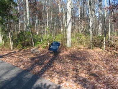
Location. 39° 47.617′ N, 77° 14.747′ W. Marker is near Gettysburg, Pennsylvania, in Adams County. It is in Cumberland Township. Memorial is on Cross Avenue, on the right when traveling west. Located in the Rose Woods section of the Gettysburg National Military Park. Touch for map. Marker is in this post office area: Gettysburg PA 17325, United States of America. Touch for directions.
Other nearby markers. At least 8 other markers are within walking distance of this marker. Captain Henry V. Fuller (about 500 feet away, measured in a direct line); 2nd Regiment Delaware Infantry (about 600 feet away); 64th New York Infantry (about 600 feet away); Fourth Brigade (about 600 feet away); Semmes's Brigade (about 700 feet away); 53rd Pennsylvania Infantry (about 700 feet away); 27th Regiment Connecticut Volunteers Position (about 700 feet away); 27th Connecticut Infantry (about 700 feet away).
Related markers. Click here for a list of markers that are related to this marker. Anderson's Brigade Tablets.
Also see . . . Reports of Col. W. W. White. After General Anderson was wounded, Col. White of the 7th Georgia assumed command. Of the final attacks in the Wheatfield he wrote:
But a short time elapsed before McLaws' division came up on our left, when General Anderson ordered another advance, which was executed with spirit and loss to the enemy. In this charge, General Anderson was wounded, in consequence of which some confusion ensued, and the command fell back a short distance the second time. The third advance was made, and resulted, after a severe conflict of half an hour in the ravine, in the rout of the enemy, which was vigorously pressed to the foot of the mountain. The loss of the enemy was here very great. From the exhausted condition of the men, together with the fact that the enemy were pouring in large re-enforcements on the right, it was deemed impracticable to follow him farther. In this charge, large numbers of prisoners were taken and sent to the rear without guard; consequently the number is not known. (Submitted on January 7, 2009, by Craig Swain of Leesburg, Virginia.)

Photographed By Craig Swain, November 11, 2008
3. The Stone Fence
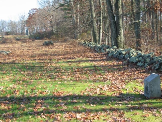
On the north side of Rose Woods is a stone fence running parallel to deTrobriand Avenue. Anderson's Brigade spent the afternoon wrestling this stone fence from Federal troops. On at least three separate occasions the brigade advanced to the Wheatfield. And even after driving the Federals from this sector the Brigade would fall back into the Rose Woods to a more defensible position.

Photographed By Craig Swain, November 11, 2008
4. Ninth Georgia Defensive Position
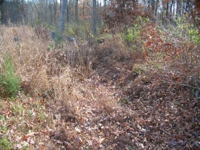
As Anderson's Brigade was pushed back out of the Wheatfield by counterattacks of the Federal forces, they found a natural defensive line along Rose Run. Over the years the Run has shifted course, leaving behind ruts. One officer of the 9th Georgia called this a "natural rifle pit."
Credits. This page was last revised on February 7, 2023. It was originally submitted on January 7, 2009, by Craig Swain of Leesburg, Virginia. This page has been viewed 1,090 times since then and 37 times this year. Photos: 1, 2, 3. submitted on January 7, 2009, by Craig Swain of Leesburg, Virginia. 4. submitted on January 26, 2009, by Craig Swain of Leesburg, Virginia.

