Salem, Virginia — The American South (Mid-Atlantic)
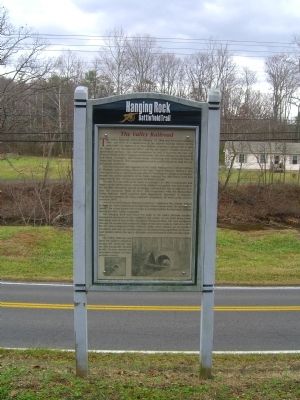
The Valley Railroad
Hanging Rock Battlefield Trail
The first president and organizer of the Valley Railroad was Colonel Michael G. Harman, commanding officer of the 52nd Virginia Infantry. Robert E. Lee, who was serving at that time as president of Washington College in Lexington, became the second president of the Valley Railroad, but died before work had begun on the line. Lee was succeeded by Robert Garrett.
The rail line was built as far south as Lexington in 1883. Construction had begun on the Salem stretch – most of the roadbed was graded, cuts were made in the hillsides, abutments erected for bridges, culverts built. But no rails were ever laid. The economic “Panic of 1873” and competition with the Shenandoah Valley Railroad, which extended from Hagerstown, Maryland, to Roanoke, Virginia had stymied the Valley Railroadís completion. All work on the rail line ceased in 1879.
One of the most famous railroad contractors, Clairborne Rice Mason, helped to build the Valley Railroad. It was said that “where Mason went, the railroad followed.” He is also known for his work as a bridge builder for Stonewall Jackson during the 1862 Valley Campaign.
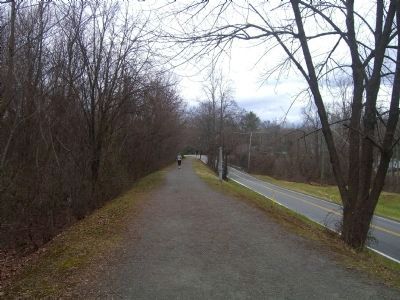
The Hanging Rock trail traces 0.3 miles of the Valley Railroad corridor. Substantial earthwork for the roadbed is still visible. At one point along North Mill Road, west of here toward Thompson Memorial Drive, the view southward through the wooded lots reveals the larger of two stone viaducts, built circa 1870 for the never-completed Valley Railroad. Today these viaducts are in excellent condition, and serve as a confirmation of the engineering capabilities of the railroad builders before the age of dynamite and mechanized earth-moving equipment.
The Valley Railroad captured the publicís attention during the post-Civil War era and was greatly favored locally. Its story remains an important chapter in transportation history.
Erected 1999 by County of Roanoke, the City of Salem, and the Hanging Rock Battlefield and Railway Preservation Foundation.
Topics. This historical
marker is listed in these topic lists: Railroads & Streetcars • War, US Civil. A significant historical date for this entry is February 23, 1741.
Location. 37° 18.702′ N, 80° 2.005′ W. Marker is in Salem, Virginia. Marker can be reached from the intersection of Keesler Mill Drive. Touch for map. Marker is in this post office area: Salem VA 24153, United States of America. Touch for directions.
Other nearby markers. At least 8 other markers are within 2 miles of this marker, measured as the crow flies. Garst / Kesler Mill (about 300 feet away, measured in a direct line); The Catawba Branch (approx. 0.6 miles away); Hanging Rock (approx. 0.9 miles away); 100th Anniversary of Hanging Rock (approx. 0.9 miles away); Two Future Presidents In Wartime Retreat (approx. one mile away); The Hanging Rock Coal Trestle (approx. 1.1 miles away); McCausland Attacks (approx. 1.1 miles away); United Daughters of the Confederacy Monuments (approx. 1.2 miles away). Touch for a list and map of all markers in Salem.
More about this marker. Marker is one of several interpretive signs along the cinder-surfaced, 1.7-mile long Hanging Rock Battlefield Trail that winds along Mason Creek and Kessler Mill Road in Salem, Virginia.
Credits. This page was last revised on June 16, 2016. It was originally submitted on January 9, 2009, by Kevin W. of Stafford, Virginia. This page has been viewed 1,355 times since then and 21 times this year. Photos: 1, 2. submitted on January 9, 2009, by Kevin W. of Stafford, Virginia. • Craig Swain was the editor who published this page.
Editor’s want-list for this marker. Pictures of the stone viaduct along North Mill Road. • Can you help?

