Doswell in Hanover County, Virginia — The American South (Mid-Atlantic)
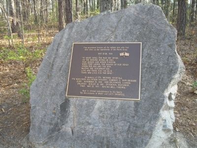
Dead of the North Anna Battlefield
“No more shall the war cry sever,
or the winding rivers be red;
They banish our anger forever
when they laurel the graves of our dead!
Under the sod and the dew,
waiting the Judgement Day;
Love and tears for the blue,
tears and love for the gray.”
In memory of Cpl. Michael Shortell 7th Wisconsin Volunteer Infantry, Company G, Iron Brigade
Born: November 24, 1840 – New Brunswick, Canada
Enlisted: August 12, 1861 – Stockton, Wisconsin
Died: May 23, 1864 – Jericho Mill, Virginia
Kept in eternal remembrance by his family
The descendants of Mary and Lucy Shortell
Topics. This historical marker is listed in this topic list: War, US Civil. A significant historical date for this entry is May 23, 1917.
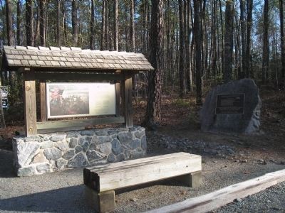
Location. 37° 52.9′ N, 77° 29.943′ W. Marker is in Doswell, Virginia, in Hanover County. Marker can be reached from Verdon Road (Virginia Route 685) 0.2 miles west of New Market Mill Road, on the right when traveling west. Marker is in the parking lot of North Anna Battlefield Park, near the trailhead. Touch for map. Marker is at or near this postal address: 11576 Verdon Rd, Doswell VA 23047, United States of America. Touch for directions.
Other nearby markers. At least 8 other markers are within walking distance of this marker. The Fight for North Anna / The North Anna Battlefield (here, next to this marker); The Ox Ford Road (approx. 0.2 miles away); Colonel Weisiger's Virginians (approx. ¼ mile away); Battle on the Skirmish Line (approx. ¼ mile away); One Brigade Alone (approx. 0.3 miles away); The Heart of Dixie (approx. 0.3 miles away); Turning Lee’s Flank (approx. 0.4 miles away); Attack at Ox Ford (approx. 0.4 miles away). Touch for a list and map of all markers in Doswell.
More about this marker. The plaque contains the crossed flags of the Union and the Confederacy.
Also see . . .
1. North Anna. CWSAC Battle Summaries website. (Submitted on January 10, 2009, by Bill Coughlin of Woodland Park, New Jersey.)
2. North Anna Battlefield Park. Hanover County Parks & Recreation (Submitted on July 3, 2014.)
Credits. This page was last revised on June 16, 2016. It was originally submitted on January 10, 2009, by Bill Coughlin of Woodland Park, New Jersey. This page has been viewed 1,980 times since then and 23 times this year. Photos: 1, 2, 3. submitted on January 10, 2009, by Bill Coughlin of Woodland Park, New Jersey.


