Cumberland Township near Gettysburg in Adams County, Pennsylvania — The American Northeast (Mid-Atlantic)
Robertson's Brigade
Stuart's Cavalry Division
— Army of Northern Virginia —
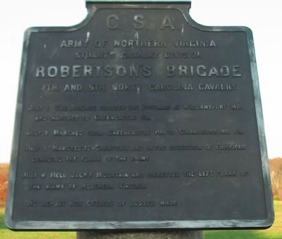
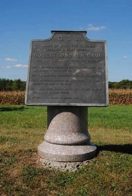
Army of Northern Virginia
Stuart's Cavalry Division
Robertson's Brigade
4th. and 5th. North Carolina Cavalry
July 1 The Brigade crossed the Potomac at Williamsport, Md. and marched to Greencastle, Pa.
July 2 Marched from Greencastle Pa. to Chambersburg Pa.
July 3 Marched to Cashtown and in the direction of Fairfield guarding the flank of the army.
July 4 Held Jack's Mountain and picketted the left flank of the Army of Northern Virginia.
No report nor details of losses made.
Erected 1910 by Gettysburg National Military Park Commission.
Topics. This historical marker is listed in this topic list: War, US Civil. A significant historical date for this entry is July 1, 1863.
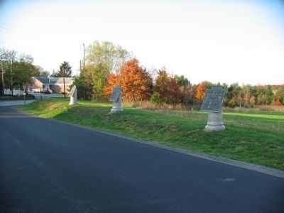
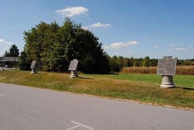
Location. 39° 49.632′ N, 77° 15.175′ W. Marker is near Gettysburg, Pennsylvania, in Adams County. It is in Cumberland Township. Marker is on Reynolds Avenue, on the left when traveling north. Located at the start of the park tour route for the First Day Battlefield, in Gettysburg National Military Park. Touch for map. Marker is in this post office area: Gettysburg PA 17325, United States of America. Touch for directions.
Other nearby markers. At least 10 other markers are within walking distance of this marker. Imboden's Brigade (a few steps from this marker); Jones's Brigade (a few steps from this marker); 121st Pennsylvania Infantry (approx. ¼ mile away); 80th New York Infantry (approx. 0.3 miles away); First Brigade (approx. 0.3 miles away); Battery A, Second U.S. Artillery (approx. 0.3 miles away); Battery B, First Pennsylvania Artillery (approx. 0.4 miles away); 142d Pennsylvania Infantry (approx. 0.4 miles away); Watson's Battery - Dance's Battalion (approx. 0.4 miles away); Johnson's Virginia Battery - McIntosh's Battalion (approx. 0.4 miles away). Touch for a list and map of all markers in Gettysburg.
Related markers. Click here for a list of markers that are related to this marker. Roberston's Cavalry Brigade during the Gettysburg Campaign.
Also see . . . General Beverly Robertson. General Robertson had just organized and trained two large North Carolina Regiments before the Gettysburg campaign. His command was assigned duty covering the passes of over the Blue Ridge and guarding the rear of the Army. (Submitted on January 10, 2009, by Craig Swain of Leesburg, Virginia.)
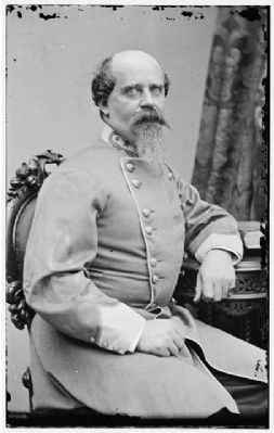
5. General Beverly Robertson
Generals Robertson and Stuart quarreled on several occasions. However, at the time of the Gettysburg Campaign, Robertson was one of the veteran cavalry commanders in the Army of Northern Virginia.
(Civil War photographs, 1861-1865 / compiled by Hirst D. Milhollen and Donald H. Mugridge, Washington, D.C. : Library of Congress, 1977. No. 1042, Call Number: LC-B813- 2009 A)
(Civil War photographs, 1861-1865 / compiled by Hirst D. Milhollen and Donald H. Mugridge, Washington, D.C. : Library of Congress, 1977. No. 1042, Call Number: LC-B813- 2009 A)
Credits. This page was last revised on February 7, 2023. It was originally submitted on January 10, 2009, by Craig Swain of Leesburg, Virginia. This page has been viewed 1,274 times since then and 29 times this year. Photos: 1. submitted on January 10, 2009, by Craig Swain of Leesburg, Virginia. 2. submitted on December 17, 2015, by Brian Scott of Anderson, South Carolina. 3. submitted on January 10, 2009, by Craig Swain of Leesburg, Virginia. 4. submitted on December 17, 2015, by Brian Scott of Anderson, South Carolina. 5. submitted on January 10, 2009, by Craig Swain of Leesburg, Virginia.
