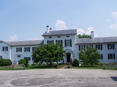
Near Monkton in Harford County, Maryland — The American Northeast (Mid-Atlantic)
Ladew Topiary Gardens and Pleasant Valley House
Erected by Maryland Historical Society.
Topics. This historical marker is listed in these topic lists: Agriculture • Architecture • Colonial Era • Horticulture & Forestry • Settlements & Settlers. A significant historical year for this entry is 1747.
Location. 39° 34.781′ N, 76° 30.903′ W. Marker is near Monkton, Maryland, in Harford County. Marker is on Jarrettsville Pike (Route 146) 0.2 miles north of Pocock Road, on the right when traveling north. Touch for map. Marker is in this post office area: Monkton MD 21111, United States of America. Touch for directions.
Other nearby markers. At least 8 other markers are within 4 miles of this marker, measured as the crow flies. Harford County Sheriff's Office (approx. 2.4 miles away); St. James’s (approx. 3.1 miles away); My Lady’s Manor (approx. 3.1 miles away); M60 A3 Tank (approx. 3.1 miles away); To Honor Those Who Served (approx. 3.1 miles away); FMK Mark 2 (approx. 3.1 miles away); a different marker also named My Lady's Manor (approx. 3.2 miles away); a different marker also named My Lady's Manor (approx. 3.2 miles away). Touch for a list and map of all markers in Monkton.
Credits. This page was last revised on January 12, 2020. It was originally submitted on June 27, 2007, by Bill Pfingsten of Bel Air, Maryland. This page has been viewed 5,252 times since then and 65 times this year. Last updated on July 2, 2007, by Bill Pfingsten of Bel Air, Maryland. It was the Marker of the Week June 24, 2007. Photos: 1, 2, 3, 4. submitted on June 27, 2007, by Bill Pfingsten of Bel Air, Maryland. • J. J. Prats was the editor who published this page.


