Near Petersburg in Dinwiddie County, Virginia — The American South (Mid-Atlantic)
“A Great Struggle is Now Impending”
The Breakthrough Trail
— Pamplin Historical Park —
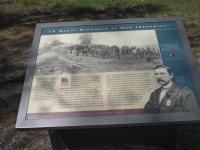
Major General Horatio G. Wright, commander of the Union Sixth Corps, took several steps to ensure that his offensive would be successful. He assigned axmen and sharpshooters to precede the infantry to remove the obstructions and pickoff enemy riflemen who might try to interfere. Soldiers received orders not to stop and return fire during their charge, which would commence at the earliest hour of daylight. Finally, an artillery bombardment of 150 guns opened on the Confederate lines at 10:00 p.m., April 1, and continued until after midnight. The barrage was designed to soften up enemy resistance and knock out the southern cannon positions.
Despite these tactics, many Federal soldiers considered their attack orders a death warrant. Some wrote their names and hometowns on pieces of paper and pinned them to their uniforms so that their bodies could be identified after they were killed. “All knew that bloody work was before us” admitted one Federal commander.
Erected by Pamplin Historical Park.
Topics. This historical marker is listed in this topic list: War, US Civil. A significant historical month for this entry is March 1896.
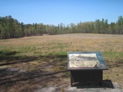
Location. 37° 10.86′ N, 77° 28.194′ W. Marker is near Petersburg, Virginia, in Dinwiddie County. Marker can be reached from Duncan Road (Virginia Route 670), on the left when traveling south. Marker is in Pamplin Historical Park, on the Breakthrough Trail. Touch for map. Marker is in this post office area: Petersburg VA 23803, United States of America. Touch for directions.
Other nearby markers. At least 8 other markers are within walking distance of this marker. A Mysterious Historic Feature (within shouting distance of this marker); “A Determination That Knew No Such Word as Fail” (about 300 feet away, measured in a direct line); Lieutenant Colonel Ronald A. Kennedy (about 500 feet away); “We Fought Desperately” (approx. 0.2 miles away); “Our Line of Battle was so Thin” (approx. 0.2 miles away); Lane’s North Carolina Brigade (approx. 0.2 miles away); 1st Lieutenant Evander McNair Robeson (approx. 0.2 miles away); Petersburg Battlefields (approx. 0.2 miles away). Touch for a list and map of all markers in Petersburg.
More about this marker. The bottom right of the marker features a photograph of "Colonel James Hubbard, 2nd Connecticut Heavy Artillery." The top of the marker contains a war-time photograph with the caption "Cannoneers like these participated
in the bombardment of the Confederate lines on the night of April 1, 1865. Although Confederate division commander Major General Cadmus Wilcox called the barrage 'an almost incessant cannonade, solid shot and shell whizzing through the air and bursting in every direction, at times equal in brilliancy to a vivid meteoric display,' the bombardment had little practical effect on the Confederate defense lines."
Also see . . . Breakthrough at Petersburg. The American Civil War website. (Submitted on January 14, 2009, by Bill Coughlin of Woodland Park, New Jersey.)
Credits. This page was last revised on February 2, 2023. It was originally submitted on January 14, 2009, by Bill Coughlin of Woodland Park, New Jersey. This page has been viewed 1,099 times since then and 24 times this year. Last updated on September 10, 2021, by Bradley Owen of Morgantown, West Virginia. Photos: 1, 2, 3. submitted on January 14, 2009, by Bill Coughlin of Woodland Park, New Jersey. • J. Makali Bruton was the editor who published this page.


