Near Petersburg in Dinwiddie County, Virginia — The American South (Mid-Atlantic)
“Our Line of Battle was so Thin”
The Breakthrough Trail
— Pamplin Historical Park —
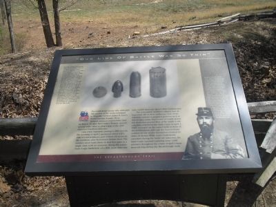
Lane’s four regiments, perhaps 1,200 men on the morning of April 2, protected about half a mile of entrenchments, part of their old sector to the northeast plus McGowan’s former front. The soldiers stood some three or four feet apart in a single rank with no reserves. Along the entire Sixth Corps battlefront of a little more than one mile, 14,000 Bluecoats faced 2,800 Confederates.
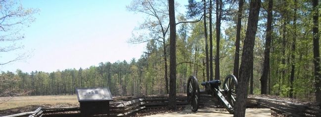
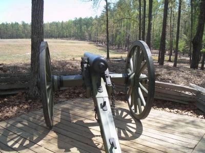
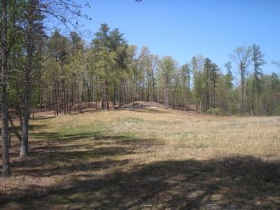
The outmanned Southern infantry had an important ally in their artillerists. Gun crews manning cannons in prepared positions such as this two-gun redan, fired scores of rounds across the shelterless ground. Most of the nearly 1,100 casualties suffered by the Sixth Corps on April 2, 1865, occurred on the naked fields in front of the fortifications, although the hand-to-hand combat on the works themselves claimed its share of victims. While exact Confederate casualties during the battle are unknown, the Sixth Corps reported capturing some 3,000 prisoners throughout the course of April 2, many surrendering during the Breakthrough itself.
Left Sidebar: Civil War artillery fired several type of ammunition designed to defend against massed attacks at relatively close range, hurling their fragments at enemy soldiers. More effective was spherical case, invented in the 18th century by an English artilleryman named Henry Shrapnel. This iron cannonball was filled with smaller iron or lead balls which exploded and scattered at a range of 500 to 1,500 yards. The most deadly anti-personnel round in the Civil War was canister. Essentially a tin can packed with 48 iron balls surrounded by sawdust, canister turned cannons into giant shotguns at short distances. Multiple rounds of canister could annihilate a line of battle at a distance of less than 600 yeards.
Right Sidebar: Brigadier General James Henry Lane a Virginian who moved before the Civil War to teach in North Carolina's military institute, was 31 years old at the time of the Breakthrough. Lane rose to brigade command in 1862 and earned the respect and affection of his troops, who called him “The Little General.” Lane suffered three wounds during the war and his brigade fought with distinction in all the army’s campaigns. One of his regiments, the 16th North Carolina, fired the volley that wounded “Stonewall” Jackson at the Battle of Chancellorsville on May 2, 1863. The 16th defended this portion of the works during the Breakthrough.
Erected by
Pamplin Historical Park.
Topics. This historical marker is listed in this topic list: War, US Civil. A significant historical month for this entry is March 1858.
Location. 37° 10.978′ N, 77° 28.342′ W. Marker is near Petersburg, Virginia, in Dinwiddie County. Marker can be reached from Duncan Road (Virginia Route 670), on the left when traveling south. Marker is in Pamplin Historical Park, on the Breakthrough Trail. Touch for map. Marker is in this post office area: Petersburg VA 23803, United States of America. Touch for directions.
Other nearby markers. At least 8 other markers are within walking distance of this marker. Lane’s North Carolina Brigade (within shouting distance of this marker); “We Fought Desperately” (within shouting distance of this marker); 1st Lieutenant Evander McNair Robeson (within shouting distance of this marker); The Breakthrough (about 400 feet away, measured in a direct line); Battlefield Terrain (about 500 feet away); a different marker also named The Breakthrough (about 600 feet away); Lieutenant Colonel Ronald A. Kennedy (about 700 feet away); The Confederate Counterattack (about 800 feet away). Touch for a list and map of all markers in Petersburg.
More about this marker. The top of the marker contains pictures of various types of ammunition fired during the Civil War. These are discussed in the left sidebar. The lower right of the marker features a photograph
of General James Henry Lane.
Also see . . .
1. Breakthrough at Petersburg. The American Civil War website. (Submitted on January 17, 2009, by Bill Coughlin of Woodland Park, New Jersey.)
2. The Breakthrough Trail. Pamplin Historical Park website. (Submitted on January 17, 2009, by Bill Coughlin of Woodland Park, New Jersey.)
3. The Final Assault. The Civil War Siege of Petersburg. (Submitted on January 17, 2009, by Bill Coughlin of Woodland Park, New Jersey.)
Credits. This page was last revised on February 2, 2023. It was originally submitted on January 17, 2009, by Bill Coughlin of Woodland Park, New Jersey. This page has been viewed 1,212 times since then and 21 times this year. Photos: 1, 2, 3, 4. submitted on January 17, 2009, by Bill Coughlin of Woodland Park, New Jersey.


