Ball Ground in Cherokee County, Georgia — The American South (South Atlantic)
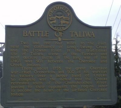
Battle of Taliwa
There, about 1755, the great Cherokee war-chief, Oconostota, led 500 of his warriors to victory over a larger band of Creeks. So complete was the defeat that the Creeks retreated south of the Chattahoochee River, leaving to their opponents the region later to become the heart of the ill-fated Cherokee Nation.
Erected 1953 by Georgia Historic Marker. (Marker Number 028-1.)
Topics and series. This historical marker is listed in these topic lists: Native Americans • Wars, US Indian. In addition, it is included in the Georgia Historical Society series list. A significant historical year for this entry is 1755.
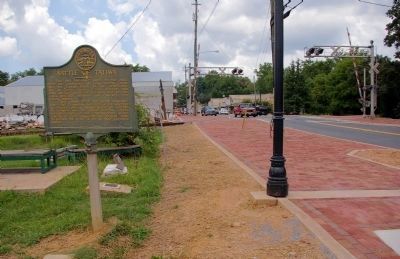
Location. 34° 20.259′ N, 84° 22.558′ W. Marker is in Ball Ground, Georgia, in Cherokee County. Marker is at the intersection of Gilmer Ferry Road (Georgia Route 372) and Valley Street, on the left when traveling west on Gilmer Ferry Road. Touch for map. Marker is in this post office area: Ball Ground GA 30107, United States of America. Touch for directions.
Other nearby markers. At least 8 other markers are within 10 miles of this marker, measured as the crow flies. Georgia Marble Company and the Village of Tate (approx. 5.3 miles away); Fort Buffington (approx. 7.1 miles away); Poole's Mill Covered Bridge (approx. 8.3 miles away); Old Federal Road (approx. 8.3 miles away); Cherokee County Gold (approx. 9.6 miles away); Cherokee County (approx. 9.6 miles away); a different marker also named Old Federal Road (approx. 9.6 miles away); Pickens County (approx. 9.6 miles away).
Credits. This page was last revised on June 16, 2016. It was originally submitted on January 20, 2009, by David Tibbs of Resaca, Georgia. This page has been viewed 2,882 times since then and 69 times this year. Photos: 1. submitted on January 20, 2009, by David Tibbs of Resaca, Georgia. 2. submitted on August 16, 2009, by David Seibert of Sandy Springs, Georgia. • Craig Swain was the editor who published this page.

