Cumberland Township near Gettysburg in Adams County, Pennsylvania — The American Northeast (Mid-Atlantic)
Bachman's Battery - Henry's Battalion
Hood's Division - Longstreet's Corps
— Army of Northern Virginia —
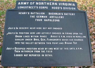
Longstreet's Corps Hood's Division
Henry's Battalion Bachman's Battery
The German Artillery
Four Napoleons
July 2 In reserve near here but not engaged.
July 3 In position here and actively engaged in firing upon the Union lines within range. About 5 p.m. aided in repelling cavalry under Brig. Gen. Farnsworth which had charged into the valley between this point and Round Top.
July 4 Occupied position near by and west of this until 6 p.m. Then withdrew from the field.
Losses not reported in detail.
Erected 1910 by Gettysburg National Military Park Commission.
Topics. This historical marker is listed in this topic list: War, US Civil. A significant historical month for this entry is July 1766.
Location. 39° 47.345′ N, 77° 15.232′ W. Marker is near Gettysburg, Pennsylvania, in Adams County. It is in Cumberland Township. Marker is on South Confederate Avenue, on the right when traveling south. Located in the Warfield Ridge section of Gettysburg National Military Park. Touch for map. Marker is in this post office area: Gettysburg PA 17325, United States of America. Touch for directions.
Other nearby markers. At least 8 other markers are within walking distance of this marker. Benning's Brigade (within shouting distance of this marker); Texas (about 400 feet away, measured in a direct line); Hood's Division (about 500 feet away); Henry's Battalion (about 500 feet away); Touring the Battlefield (about 500 feet away); Hood's Texas Brigade (about 500 feet away); Latham's Battery - Henry's Battalion (about 500 feet away); Robertson's Brigade (about 500 feet away). Touch for a list and map of all markers in Gettysburg.

Photographed By Craig Swain, November 11, 2008
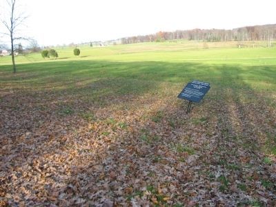
3. Bachman's Battery Fires on Farnsworth's Cavalry
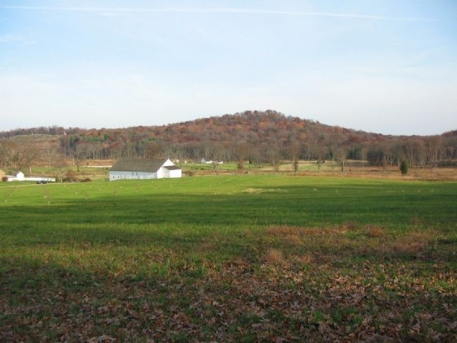
Looking west past the tablet. In the center is the Bushman Farm. The white buildings beyond are the Slyder Farm. Big Round Top is the high wooded knoll in the distance, with the monuments on Little Round Top to the left. Bachman's South Carolina Battery was posted on the south end of Warfield ridge on July 3. Federal Cavalry under Brig. Gen. Farnsworth made an ill-fated mounted charge on the Confederate right flank in the afternoon of the 3rd. While several different interpretations exist regarding the route taken by the Federals, all agree the cavalry were caught in a crossfire between several Confederate forces.
Credits. This page was last revised on February 7, 2023. It was originally submitted on January 20, 2009, by Craig Swain of Leesburg, Virginia. This page has been viewed 1,097 times since then and 23 times this year. Photos: 1, 2, 3. submitted on January 20, 2009, by Craig Swain of Leesburg, Virginia.

