Cumberland Township near Gettysburg in Adams County, Pennsylvania — The American Northeast (Mid-Atlantic)
Benning's Brigade
Hood's Division - Longstreet's Corps
— Army of Northern Virginia —
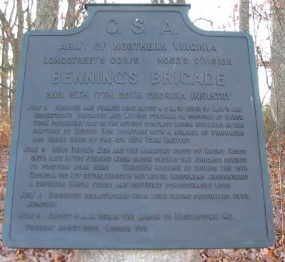
Army of Northern Virginia
Longstreet's Corps Hood's Division
Benning's Brigade
2nd. 15th. 17th. 20th. Georgia Infantry
July 2 Arrived and formed line about 4 p.m. in rear of Law's and Robertson's Brigades and moving forward in support of these took prominent part in the severe conflict which resulted in the capture of Devil's Den together with a number of prisoners and three guns of the 4th New York Battery.
July 3 Held Devil's Den and the adjacent crest of Rocky Ridge until late in the evening when under orders the Brigade retired to position near here. Through mistake of orders the 15th Georgia did not retire directly but moved northward encountered a superior Union force and suffered considerable loss.
July 4 Occupied breastworks near here facing southward until midnight.
July 5 About 5 a.m. began the march to Hagerstown, Md.
Present about 1500. Losses 509.
Erected 1910 by Gettysburg National Military Park Commission.
Topics. This historical marker is listed in this topic list: War, US Civil. A significant historical month for this entry is July 1766.
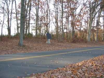
Location. 39° 47.302′ N, 77° 15.235′ W. Marker is near Gettysburg, Pennsylvania, in Adams County. It is in Cumberland Township. Marker is on South Confederate Avenue, on the left when traveling south. Located in the Warfield Ridge section of Gettysburg National Military Park. Touch for map. Marker is in this post office area: Gettysburg PA 17325, United States of America. Touch for directions.
Other nearby markers. At least 8 other markers are within walking distance of this marker. Henry's Battalion (within shouting distance of this marker); Bachman's Battery - Henry's Battalion (within shouting distance of this marker); Touring the Battlefield (about 400 feet away, measured in a direct line); Gettysburg Campaign (about 500 feet away); Fourth Alabama Infantry - Law's Brigade (about 500 feet away); Law's Brigade (about 600 feet away); Garden's Battery - Henry's Battalion (about 600 feet away); Texas (about 600 feet away). Touch for a list and map of all markers in Gettysburg.
Related markers. Click here for a list of markers that are related to this marker. Benning's Brigade at Gettysburg.
Also see . . . Report of Brig. Gen. Henry L. Benning. Gen. Benning described the advance forward from Warfield Ridge to the Devil's Den in his official report:
Thus, what we had to encounter were thirteen guns, and two, if not more, lines of infantry posted on mountain heights. The intervening spur over which we had to march to reach the first line was nearly all open. Our own first line also became visible advancing about 400 yards in our front. The part of it in our front
I took to be Law's brigade, and so I followed it. In truth, it was Robertson's, Law's being farther to the right. This I did not discover until late in the fight, a wood on the right concealing from me most of Law's brigade. My line continued to follow the first line, halting once or twice to preserve its interval. At length I saw that the first line would not be able alone to carry the peak, so I advanced without halting again. (Submitted on January 20, 2009, by Craig Swain of Leesburg, Virginia.)

Photographed By Craig Swain, November 8, 2008
3. Benning's Brigade Base Position
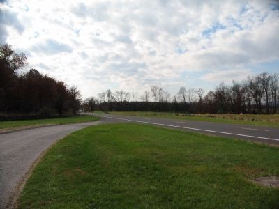
Looking south from the Gettysburg Battlefield south information center along Emmitsburg Road. Benning's Brigade arrived and formed a line of battle on the west side of the road in the afternoon of July 2. The Brigade was on the right of Hood's second rank in the advance, with Law's and Robertson's Brigades to their front.

Photographed By Craig Swain, November 11, 2008
4. Benning's Brigade Advances
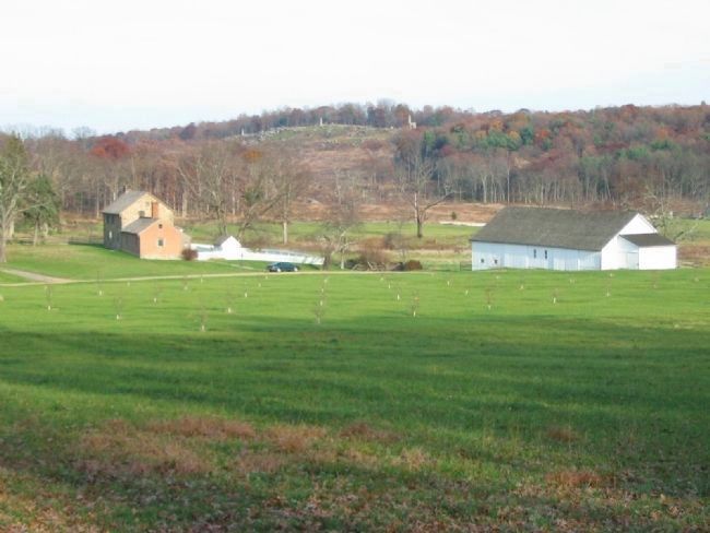
Looking from South Confederate Avenue to the east across Benning's line of march. In the foreground is an orchard being replanted to restore the wartime appearance. The buildings are the Bushman Farm. Beyond, in the brown patches are first the a low ridge line where the Timbers house stood during the battle. Barely visible beyond that are the rock outcroppings of the Devil's Den. Then, very much dominating the path, are the monuments on top of Little Round Top. Benning followed the left wing of Robertson's Brigade to the Devil's Den, thinking that to be Law's Brigade. See "related markers" for Benning's second tablet at the Devil's Den to see the terrain confronting the Georgians there.
Credits. This page was last revised on February 7, 2023. It was originally submitted on January 20, 2009, by Craig Swain of Leesburg, Virginia. This page has been viewed 1,256 times since then and 59 times this year. Photos: 1, 2, 3, 4. submitted on January 20, 2009, by Craig Swain of Leesburg, Virginia.

