Cumberland Township near Round Top in Adams County, Pennsylvania — The American Northeast (Mid-Atlantic)
Farnsworth's Cavalry Charge
July 3, 1863 - Third Day
Capt. H.C. Parsons, U.S.A.
1st Vermont Cavalry, Farnsworth's Brigade
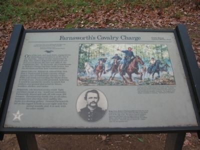
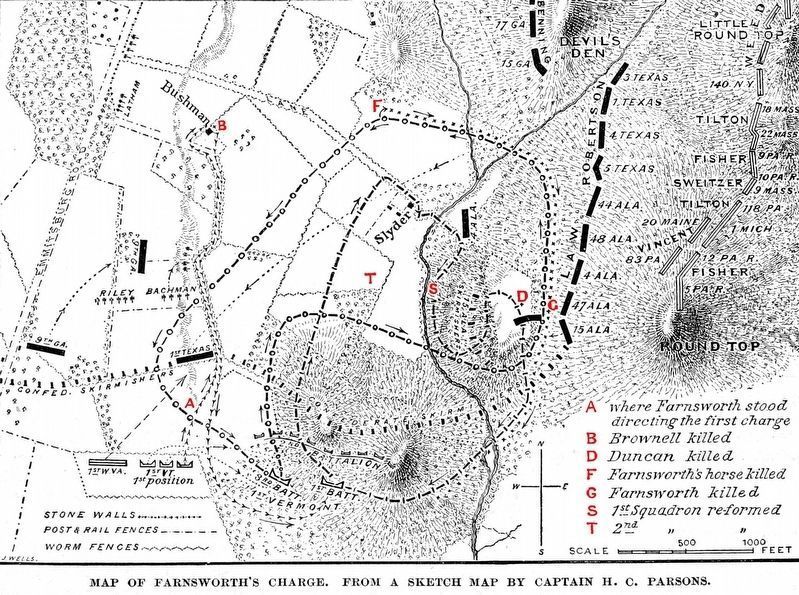
One of the last, and most futile, engagements at Gettysburg occurred here at the end of the third day. Union cavalry commanded by Brig. Gen. Judson Kilpatrick had moved into this area to harass the rear and right of the Confederate line. To the north, the Confederates in Pickett's Charge had been badly beaten, but the Southern position here remained strong.
About 5:00 p.m., Kilpatrick ordered Brig. Gen. Elon J. Farnsworth to lead a cavalry charge against a line of Confederate infantry in the fields and woods surrounding the Slyder Farm in front of you. Farnsworth protested, believing it would be suicidal for cavalry to attack foot soldiers over ground obstructed by fences, boulders, ditches, and timber.
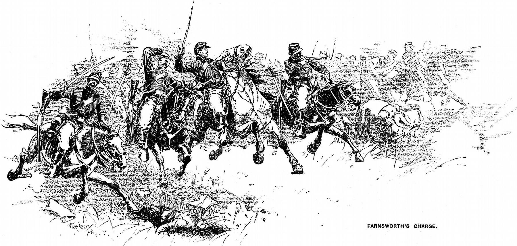
Kilpatrick, who boasted cavalry could "fight anywhere except at sea," would not reconsider. Farnsworth obeyed and rode off with some 300 troopers. Encountering deadly fire on all sides, horsemen were shot from their saddles like ducks in a shooting gallery. General Farnsworth fell on the rugged hillside to your right with five mortal wounds, and, it is said, with his saber raised.
Erected by Gettysburg National Military Park.
Topics. This historical marker is listed in this topic list: War, US Civil.
Location. This marker has been replaced by another marker nearby. It was located near 39° 47.133′ N, 77° 14.793′ W. Marker was near Round Top, Pennsylvania, in Adams County. It was in Cumberland Township. Marker was on South Confederate Avenue, on the left when traveling east. Located at a wayside pull off between Bushman Hill and Big Round Top in Gettysburg National Military Park. Touch for map. Marker was in this post office area: Gettysburg PA 17325, United States of America. Touch for directions.
Other nearby markers. At least 8 other markers are within walking distance of this location. Farm Field to Battlefield (here, next to this marker); A Ride to Death (a few steps from this marker); William Wells (about 400 feet away, measured in a direct line); First Brigade (about 500 feet away); Battery E, Fourth U.S. Artillery (about 800 feet away); 5th New York Cavalry (approx. 0.2 miles away); 18th Pennsylvania Cavalry (approx. 0.2 miles away); First Regiment Vermont Cavalry (approx. 0.2 miles away). Touch for a list and map of all markers in Round Top.
More about this marker. In the upper center and right is a painting depicting the charge. Union cavalry of Farnsworth's Brigade hurdle obstacles
and whirl to avoid Confederate marksmen. General Farnsworth (center) was knocked from his horse twice, the second time mortally wounded. 65 troopers were killed, wounded, or missing. Painting by Gil Cohen.
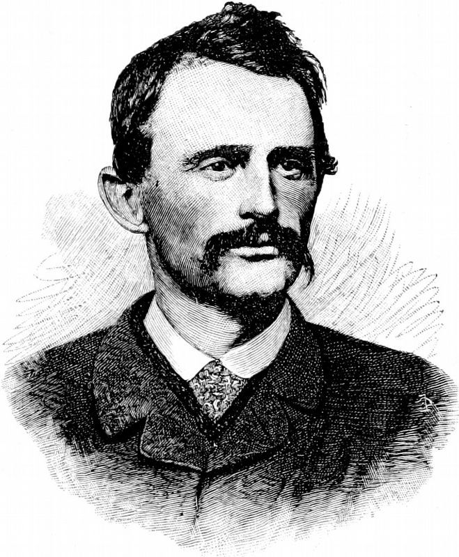
In the lower center is a portrait of Farnsworth. Brig. Gen. Elon J. Farnsworth had held the rank of general only four days when he rode to his death here at the age of 25. He had no formal military training, and had risen to high rank on ability. When ordered to make the fatal charge, he asked his superior, "General, do you mean it?... these men are too good to kill."
Related markers. Click here for a list of markers that are related to this marker. South Cavalry Battlefield markers and monuments.
Also see . . . A Defense of the "Traditional Approach". Historians Eric Whittenberg and J. David Petruzzi wrote this essay to defend the "traditional" interpretation of the Farnsworth Charge. As mentioned, the charge has received much attention in the pages of Blue and Gray Magazine. (Submitted on January 21, 2009, by Craig Swain of Leesburg, Virginia.)
Photographed By Craig Swain, November 11, 2008
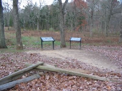
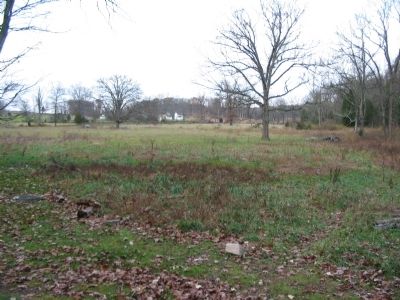
3. Start of Farnsworth's Charge
Looking north from the waysides. The Slyder Farm buildings are in the far center. Plum Run passes to the right near the tree line. Under the traditional interpretation of the charge, Farnsworth and Major William Wells lead one battalion each charging down the west side of Plum Run (directly to the front in this view). Captain Parsons (quoted on the marker) charged on the east side of the run.
Credits. This page was last revised on February 7, 2023. It was originally submitted on January 21, 2009, by Craig Swain of Leesburg, Virginia. This page has been viewed 2,685 times since then and 120 times this year. Photos: 1, 2, 3. submitted on January 21, 2009, by Craig Swain of Leesburg, Virginia. 4, 5, 6. submitted on October 11, 2018, by Allen C. Browne of Silver Spring, Maryland.
