Amesville in Athens County, Ohio — The American Midwest (Great Lakes)
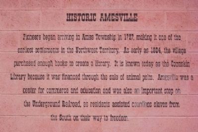
Historic Amesville
Erected by TEAM Athens County.
Topics. This historical marker is listed in these topic lists: Abolition & Underground RR • Charity & Public Work • Education • Industry & Commerce • Notable Places • Settlements & Settlers. A significant historical year for this entry is 1797.
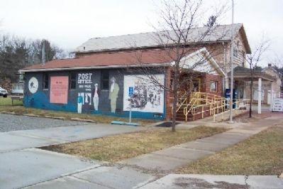
Location. 39° 24.038′ N, 81° 57.341′ W. Marker is in Amesville, Ohio, in Athens County. Marker is at the intersection of State Street (Ohio Route 550), on the left when traveling east on State Street. Mural is painted on the west facade of the Amesville post office. Touch for map. Marker is in this post office area: Amesville OH 45711, United States of America. Touch for directions.
Other nearby markers. At least 8 other markers are within 9 miles of this marker, measured as the crow flies. Ames Academy Bell (within shouting distance of this marker); Western Library Association (within shouting distance of this marker); Frank Henry Gifford (within shouting distance of this marker); Millfield Coal Mine Disaster (approx. 6.9 miles away); Quaker Meeting House (approx. 7.8 miles away); Millfield Mine No. 6 - 1205 Disaster (approx. 7.9 miles away); Todd and Tony Carr Memorial (approx. 8.4 miles away); Athens County Infirmary (approx. 8.8 miles away). Touch for a list and map of all markers in Amesville.
Credits. This page was last revised on June 16, 2016. It was originally submitted on January 22, 2009, by William Fischer, Jr. of Scranton, Pennsylvania. This page has been viewed 1,682 times since then and 65 times this year. Photos: 1, 2, 3, 4. submitted on January 22, 2009, by William Fischer, Jr. of Scranton, Pennsylvania. • Kevin W. was the editor who published this page.


