Cumberland Township near Round Top in Adams County, Pennsylvania — The American Northeast (Mid-Atlantic)
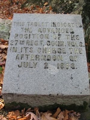
27th Regiment Connecticut Volunteers Position
Erected 1885.
Topics. This memorial is listed in this topic list: War, US Civil. A significant historical date for this entry is July 2, 1863.
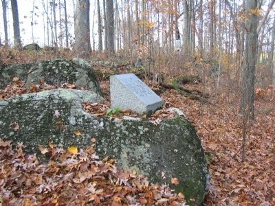
Location. 39° 47.718′ N, 77° 14.815′ W. Marker is near Round Top, Pennsylvania, in Adams County. It is in Cumberland Township. Memorial can be reached from Brooke Avenue, on the right when traveling north. Located in the Rose Woods, a short distance from the Avenue, in Gettysburg National Military Park. Touch for map. Marker is in this post office area: Gettysburg PA 17325, United States of America. Touch for directions.
Other nearby markers. At least 8 other markers are within walking distance of this marker. 53rd Pennsylvania Infantry (a few steps from this marker); 27th Connecticut Infantry (a few steps from this marker); Fourth Brigade (within shouting distance of this marker); Semmes's Brigade (within shouting distance of this marker); 145th Pennsylvania Infantry (within shouting distance of this marker); 64th New York Infantry (within shouting distance of this marker); 2nd Regiment Delaware Infantry (within shouting distance of this marker); Kershaw's Brigade (within shouting distance of this marker). Touch for a list and map of all markers in Round Top.
Credits. This page was last revised on February 7, 2023. It was originally submitted on January 26, 2009, by Craig Swain of Leesburg, Virginia. This page has been viewed 1,145 times since then and 11 times this year. Photos: 1, 2. submitted on January 26, 2009, by Craig Swain of Leesburg, Virginia.

