West Sacramento in Yolo County, California — The American West (Pacific Coastal)
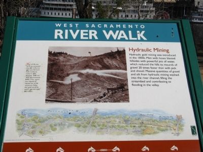
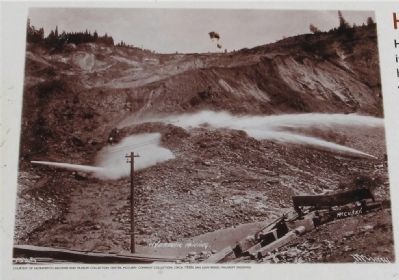
Hydraulic Mining
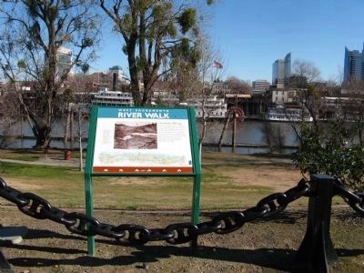
West Sacramento River Walk
The U.S. Bureau of Mines, estimated that $81 million in gold was removed from California mines in 1852. Between 1848 and 1855, approximately $400 million worth was chipped or blasted out of the mountains. Today, that gold would be worth approximately $8.5 billion.
Erected by City of West Sacramento.
Topics. This historical marker is listed in these topic lists: Environment • Industry & Commerce • Notable Events • Waterways & Vessels. A significant historical year for this entry is 1852.
Location. 38° 34.993′ N, 121° 30.526′ W. Marker is in West Sacramento, California, in Yolo County. Marker can be reached from 2nd Street. Marker is located on the “River Walk” at River Walk Park on the Sacramento River. The park is located at the end of the 600 block of 2nd Street. Touch for map. Marker is in this post office area: West Sacramento CA 95605, United States of America. Touch for directions.
Other nearby markers. At least 8 other markers are within walking distance of this marker . Veterans Plaza (here, next to this marker); The Rivers’ Flow (here, next to this marker); Pony Express Bridge (a few steps from this marker); Salmon Cannery (a few steps from this marker); First Pacific Coast Salmon Cannery (a few steps from this marker); Flood Control (within shouting distance of this marker); Sacramento Skyline (within shouting distance of this marker); Influences on the River (within shouting distance of this marker). Touch for a list and map of all markers in West Sacramento.
Also see . . .
1. Giant Gold Machines – Hydraulic Mining. Gold Fever! entry. (Submitted on January 29, 2009, by Syd Whittle of Mesa, Arizona.)
2. Hydraulic Mining Photo Gallery. (Submitted on January 29, 2009, by Syd Whittle of Mesa, Arizona.)
Additional commentary.
1. Hydraulic Mining
Hydraulic Mining was the quickest method of mining gold in placer deposits. Water would be carried to the mining site via canals and ditches. From there the water would flow into a hose.
The opening of the hose was larger and higher than the other end. Attached to the end was a pipe. The weight of the water going into the hose would force it out the other end at great pressure. As the jet of water cut
into the hillside, it would wash the dirt and gravel down into a sluice box. This type of extraction, had vast environmental impacts.
— Submitted January 29, 2009, by Syd Whittle of Mesa, Arizona.
Additional keywords. Gold Rush
Credits. This page was last revised on September 16, 2020. It was originally submitted on January 29, 2009, by Syd Whittle of Mesa, Arizona. This page has been viewed 1,734 times since then and 15 times this year. Photos: 1, 2, 3. submitted on January 29, 2009, by Syd Whittle of Mesa, Arizona.


