Cumberland Township near Gettysburg in Adams County, Pennsylvania — The American Northeast (Mid-Atlantic)
First Brigade
First Division - Fifth Corps
— Army of the Potomac —
Inscription.
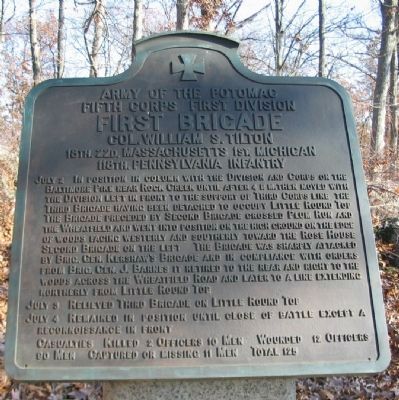
Fifth Corps First Division
First Division
Col. William S. Tilton
18th. 22d. Massachusetts 1st. Michigan
118th. Pennsylvania Infantry
July 2 In position in column with the Division and Corps on the Baltimore Pike near Rock Creek until after 4 p.m. then moved with the Division left in front to the support of Third Corps line the Third Brigade having been detached to occupy Little Round Top. The Brigade preceded by Second Brigade crossed Plum Run and the Wheatfield and went into position on the high ground on the edge of woods facing westerly and southerly toward the Rose House. Second Brigade on the left. The Brigade was sharply attacked by Brig. Gen. Kershaw's Brigade and in compliance with orders from Brig. Gen. J. Barnes it retired to the rear and right to the woods across the Wheatfield Road and later to a line extending northerly from Little Round Top.
July 3 Relieved Third Brigade on Little Round Top.
July 4 Remained in position until close of battle except a reconnoissance in front.
Casualties. Killed 2 officers 10 men. Wounded 12 officers 90 men. Captured or missing 11 men. Total 125.
Erected 1912 by Gettysburg National Military Park Commission.
Topics. This historical marker is listed in this topic list: War, US Civil. A significant historical date for this entry is July 2, 1863.
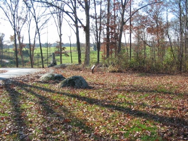
Location. 39° 47.835′ N, 77° 14.78′ W. Marker is near Gettysburg, Pennsylvania, in Adams County. It is in Cumberland Township. Marker is on Sickles Avenue, on the right when traveling north. Located at the "Loop" on Stony Hill in Gettysburg National Military Park. Touch for map. Marker is in this post office area: Gettysburg PA 17325, United States of America. Touch for directions.
Other nearby markers. At least 8 other markers are within walking distance of this marker. 22nd Massachusetts Infantry (a few steps from this marker); First Michigan Infantry (a few steps from this marker); 2nd Company Andrew Sharpshooters (within shouting distance of this marker); 18th Massachusetts Volunteers (within shouting distance of this marker); 32nd Massachusetts Infantry (within shouting distance of this marker); 140th Pennsylvania Infantry (within shouting distance of this marker); 116th Pennsylvania Infantry (within shouting distance of this marker); 118th Pennsylvania Infantry (within shouting distance of this marker). Touch for a list and map of all markers in Gettysburg.
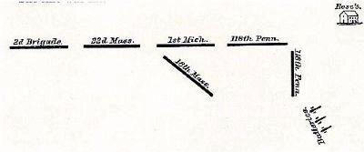
Also see . . . Report of Col. William S. Tilton. Col. Tilton provided a small diagram of his Brigade dispositions on Stony Hill as part of his report. This arrangement from left to right was the 22nd Massachusetts, 1st Michigan,
118th Pennsylvania, with the 18th Massachusetts in reserve - an arrangement seen today by the monument locations. Describing the action Tilton stated:
No sooner was the line formed than the foe attacked our front. The onslaught was terrible and my losses heavy--so much so that I was somewhat doubtful if our line could withstand it. This fact I communicated to the general commanding division, who ordered me to fall back in good order if unable to hold the position; but my men behaved nobly, and twice repulsed the assailants. My colonels wished to advance. Being anxious about my right, however, I reconnoitered in person, and discovered the enemy in large force coming from the direction of Rose's house, with the evident design of outflanking me. I immediately retired and took up a new position (in two lines), at the left and rear of a battery which had been posted about 300 yards to my right and rear. The battery soon commenced to retreat, firing, followed by the rebels, who were now again upon my right flank. To avoid this flank movement, I retired, firing, a short distance in the timber, and then moved across an open field, took up a new position upon the right of the Second Division, and reported to General Sykes. (Submitted on January 31, 2009, by Craig Swain of Leesburg, Virginia.)

Photographed By Craig Swain, November 11, 2008
4. The Refuse of Tilton's Line
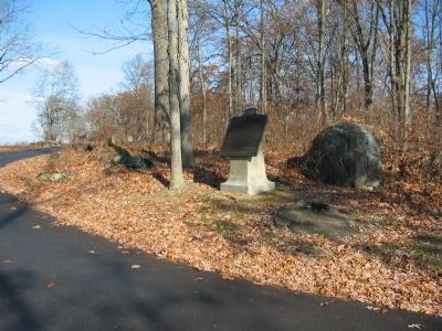
Looking back to the west from the north side of the "loop" of Sickles Avenue. In the center beside the road is the 1st Michigan Monument. In the trees to the right, just out of view due to the slope of ground is the 118th Pennsylvania Infantry Monument. The Rose Farm is seen through the trees in the distance. The left of Tilton's line extended from the 1st Michigan monument, with the 22nd Massachusetts Infantry to their left. To the right of this photo was the 118th Pennsylvania. Half of the regiment was faced to the right in order to prevent a flanking attack.
Credits. This page was last revised on February 7, 2023. It was originally submitted on January 31, 2009, by Craig Swain of Leesburg, Virginia. This page has been viewed 963 times since then and 9 times this year. Photos: 1, 2, 3, 4. submitted on January 31, 2009, by Craig Swain of Leesburg, Virginia.


