Cumberland Township near Gettysburg in Adams County, Pennsylvania — The American Northeast (Mid-Atlantic)
Third Division
Fifth Corps
— Army of the Potomac —
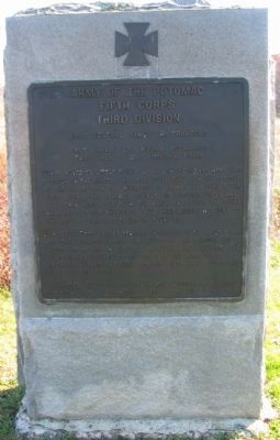
Inscription.
Fifth Corps
Third Division
Brig. General Samuel W. Crawford
First Brigade Col. William McCandless
Third Brigade Col. Joseph W. Fisher
July 2. Moved to Little Round Top late in the day and went into position on the right of the Wheatfield Road. On the retreat of the troops from the Wheatfield in front after sunset the First Brigade was advanced against the pursuing forces and drove them across the Plum Run marsh and beyond the stone wall and into the Wheatfield. The Third Brigade was sent to the left to take possession of Round Top.
July 3. The first Brigade remained in position until about 5 p.m. and then advanced across the Wheatfield and through the woods beyond and on the left capturing many prisoners. The Confederates retired to the crest of the ridge they originally formed on. These positions were held until the close of the battle.
Casualties. Killed 3 officers 23 men. Wounded 17 officers 164 men. Captured or missing 3 men. Total 210
Erected 1910 by Gettysburg National Military Park Commission.
Topics. This historical marker is listed in this topic list: War, US Civil. A significant historical date for this entry is July 2, 1861.
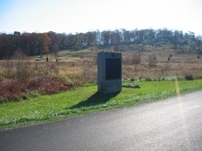
Location. 39° 47.743′ N, 77° 14.329′ W. Marker is near Gettysburg, Pennsylvania, in Adams County. It is in Cumberland Township. Marker is on Crawford Avenue, on the right when traveling north. Located in Plum Run Valley (the Valley of Death) in Gettysburg National Military Park. Touch for map. Marker is in this post office area: Gettysburg PA 17325, United States of America. Touch for directions.
Other nearby markers. At least 8 other markers are within walking distance of this marker. Brigadier General Samuel Wiley Crawford (within shouting distance of this marker); Second Division (about 300 feet away, measured in a direct line); 96th Regiment Pennsylvania Volunteers (about 300 feet away); 3rd Massachusetts Battery (about 400 feet away); 139th Pennsylvania Infantry (about 400 feet away); Third Brigade (about 500 feet away); Fourth New York Independent Battery (about 600 feet away); Third U.S. Infantry (about 600 feet away). Touch for a list and map of all markers in Gettysburg.
Also see . . . Reports of Brig. Gen. Samuel W. Crawford. Concerning the actions on July 3, Crawford wrote that upon entering the Wheatfield, scene of a bloody struggle the previous day, ...The dead of both sides lay in lines in every direction, and the large number of our own men showed how fierce had been the struggle and how faithfully and how persistently they had contested for the field against the superior masses of the enemy. (Submitted on February 1, 2009, by Craig Swain of Leesburg, Virginia.)

Photographed By Craig Swain, November 11, 2008
3. Advance of McCandless' Brigade
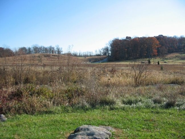
Looking east toward the north side of Little Round top. Wheatfield road passes up the slope in the center to intersect with Sykes Avenue. Crawford's Division was arrived on the high ground overlooking the valley as the later stages of the Wheatfield Contest played out. As the US Regulars were pushed from the field in the early evening, pursuing Confederates threatened to take Little Round Top from the north side. McCandless' Brigade charged to check the Confederates, advancing down the slopes here, across Plum Run, and up the ridge behind the camera.
Credits. This page was last revised on February 7, 2023. It was originally submitted on February 1, 2009, by Craig Swain of Leesburg, Virginia. This page has been viewed 798 times since then and 8 times this year. Photos: 1, 2, 3. submitted on February 1, 2009, by Craig Swain of Leesburg, Virginia.

