Hanover in Hanover County, Virginia — The American South (Mid-Atlantic)
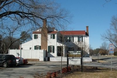
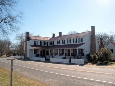
Hanover Tavern
War Comes to Hanover Courthouse
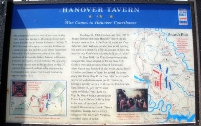
This community’s first real taste of war came in May 1862, when Gen. George B. McC1e11an’s Union army moved from the east to threaten Richmond. On May 25, McClellan ordered troops to reconnoiter the Hanover Courthouse area and push back any enemy found there. Meanwhile, Confederates concentrated four miles southwest of here around Peake’s Turnout, with orders to protect the Virginia Central Railroad. The opposing forces made contact near the Peakes depot on May 27, a spirited fight ensued, and late in the afternoon the Confederates were pressed back toward Ashland by superior Federal force.
On June 12, 1862, Confederate Gen. J.E.B. Stuart led his men past Hanover Tavern on his famous reconnoiter of the Federal positions. Confederate Capt. William Latane was killed leading his men in a skirmish a few miles east of here. He was the only Confederate fatality in Stuart’s “ride.”
n May 1864, the Courthouse community escaped the direct impact of Union Gen. U.S. Grant’s overland advance toward Richmond. After Grant was blocked at the North Anna River 12 miles northwest of here, he moved his army along the Pamunkey River (one mile north) probing for a Confederate weak point. Operating behind a cavalry screen in this area, Confederate Gen. Robert E. Lee moved once again to block Grant. Late on May 26, Grant began crossing the Pamunkey at Nelson’s Ferry four miles east of here and moved toward Totopotomoy Creek. Tavern residents, mostly battle-weary refugees from Northern Virginia, breathed sighs of relief.
(captions)
Battle of Hanover Courthouse (Slash Church) May 27, 1862. (inset)37th NC flag with battle honors -The Museum of the Confederacy.
“The Burial of Latane” by William D. Washington (1864). -The Museum of the Confederacy.
Stuart’s Ride J.E.B. Stuart led 1,200 men in a daring 100-mile reconnaissance ride around McClellan’s army June 12-15, 1862.
Erected by Virginia Civil War Trails.
Topics and series. This historical marker is listed in this topic list: War, US Civil. In addition, it is included in the Former U.S. Presidents: #18 Ulysses S. Grant, and the Virginia Civil War Trails series lists. A significant historical date for this entry is May 25, 1862.
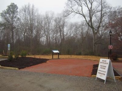
Location. This marker has been replaced by another marker nearby. It was located near 37° 45.731′ N, 77° 22.049′ W. Marker was in Hanover, Virginia, in Hanover County. Marker was on Hanover Courthouse Road (U.S. 301) 0.2 miles north of Depot Road, on the left when traveling north. The marker is in the northwest corner of the parking lot. Touch for map. Marker was at or near this postal address: 13181 Hanover Courthouse Road, Hanover VA 23069, United States of America. Touch for directions.
Other nearby markers. At least 8 other markers are within walking distance of this location. A different marker also named Hanover Tavern (here, next to this marker); a different marker also named Hanover Tavern (a few steps from this marker); a different marker also named Hanover Tavern (within shouting distance of this marker); The Fields Family (about 300 feet away, measured in a direct line); Hanover Confederate Soldiers Monument (about 400 feet away); Hanover Courthouse (about 400 feet away); a different marker also named Hanover Courthouse (about 400 feet away); Patrick Henry (about 400 feet away). Touch for a list and map of all markers in Hanover.
More about this marker. This marker was replaced by a new one also named "Hanover Tavern" (see nearby markers).
Related marker. Click here for another marker that is related to this marker. This marker has been replaced by the linked marker.
Also see . . .
1. CWSAC Battle Summary. Hanover Court House (Submitted on February 3, 2009.)
2. Hanover Tavern Foundation. (Submitted on February 3, 2009.)
3. Civil War Traveler. Hanover County (Submitted on February 12, 2009.)
Credits. This page was last revised on September 30, 2022. It was originally submitted on February 3, 2009, by Bernard Fisher of Richmond, Virginia. This page has been viewed 2,496 times since then and 48 times this year. Photos: 1. submitted on February 3, 2009, by Bernard Fisher of Richmond, Virginia. 2. submitted on January 13, 2013, by Bernard Fisher of Richmond, Virginia. 3, 4. submitted on February 3, 2009, by Bernard Fisher of Richmond, Virginia. 5, 6. submitted on February 16, 2009, by Bernard Fisher of Richmond, Virginia. 7. submitted on September 27, 2010, by Bernard Fisher of Richmond, Virginia. 8. submitted on February 3, 2009, by Bernard Fisher of Richmond, Virginia. • Craig Swain was the editor who published this page.
