Glen Allen in Henrico County, Virginia — The American South (Mid-Atlantic)
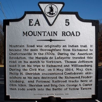
Mountain Road
Erected 1995 by Department of Historic Resources. (Marker Number EA-5.)
Topics and series. This historical marker is listed in these topic lists: War, US Civil • War, US Revolutionary. In addition, it is included in the Former U.S. Presidents: #03 Thomas Jefferson, and the Virginia Department of Historic Resources (DHR) series lists. A significant historical date for this entry is May 11, 1864.
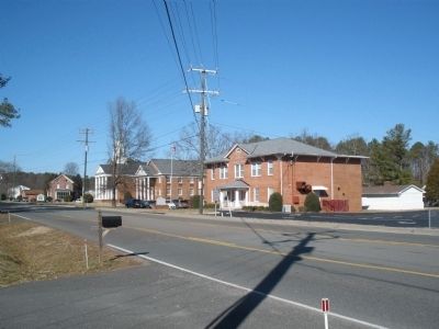
Location. 37° 40.008′ N, 77° 30.477′ W. Marker is in Glen Allen, Virginia, in Henrico County. Marker is on Mountain Road, 0.1 miles west of John Cussons Drive, on the right when traveling west. The marker is located in front of the Glen Allen Masonic Temple. Touch for map. Marker is at or near this postal address: 3024 Mountain Road, Glen Allen VA 23060, United States of America. Touch for directions.
Other nearby markers. At least 8 other markers are within walking distance of this marker. Glen Allen Baptist Church (about 400 feet away, measured in a direct line); Glen Allen (about 500 feet away); John Cussons (approx. 0.3 miles away); Forest Lodge (approx. 0.3 miles away); Forest Lodge Belvedere (approx. 0.3 miles away); Glen Allen School (approx. 0.4 miles away); Walkerton (approx. half a mile away); Sheppard and Baker's Grant (approx. half a mile away). Touch for a list and map of all markers in Glen Allen.
Credits. This page was last revised on June 16, 2016. It was originally submitted on February 3, 2009, by Bernard Fisher of Richmond, Virginia. This page has been viewed 1,707 times since then and 86 times this year. Photos: 1, 2. submitted on February 3, 2009, by Bernard Fisher of Richmond, Virginia. • Craig Swain was the editor who published this page.

