Louisville in Jefferson County, Georgia — The American South (South Atlantic)
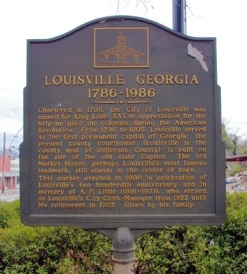
Louisville, Georgia
1786 - 1986
This marker erected in 1986 in celebration of Louisville’s two hundredth anniversary and in memory of A.P. Little (1891-1971), who served as Louisville’s City Clerk-Manager from 1922 until his retirement in 1967. Given by his family.
Erected by Family of A. P. Little.
Topics. This historical marker is listed in these topic lists: Settlements & Settlers • War, US Revolutionary. A significant historical year for this entry is 1786.
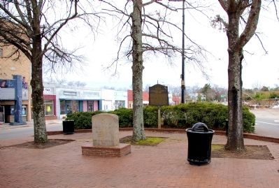
Location. 33° 0.036′ N, 82° 24.607′ W. Marker is in Louisville, Georgia, in Jefferson County. Marker is at the intersection of East Broad Street (Business U.S. 1) and Walnut Street, in the median on East Broad Street. Touch for map. Marker is in this post office area: Louisville GA 30434, United States of America. Touch for directions.
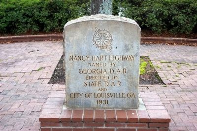
Other nearby markers. At least 8 other markers are within walking distance of this marker. Nancy Hart Highway (here, next to this marker); Pal Theater (within shouting distance of this marker); Knights of Pythias Building (within shouting distance of this marker); Market House (about 300 feet away, measured in a direct line); Abbot & Stone Building (about 300 feet away); First National Bank & Trust Building (about 300 feet away); Louisville U.S. Bicentennial Time Capsule (about 300 feet away); The Louisville Drug Store (about 400 feet away). Touch for a list and map of all markers in Louisville.
More about this marker. The marker was originally erected at the intersection of Business US 1 and US 1 at the edge of Louisville. The City Manager moved the marker to its present location in 1992 or '93.
Credits. This page was last revised on January 31, 2020. It was originally submitted on February 6, 2009, by David Seibert of Sandy Springs, Georgia. This page has been viewed 2,600 times since then and 45 times this year. Photos: 1, 2, 3. submitted on February 6, 2009, by David Seibert of Sandy Springs, Georgia. • Kevin W. was the editor who published this page.


