Marinette in Marinette County, Wisconsin — The American Midwest (Great Lakes)
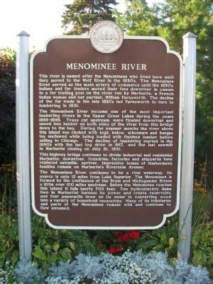
Menominee River
The Menominee River became one of the most important lumbering rivers in the Upper Great Lakes during the years 1865–1895. Trees cut upstream were floated downriver and sawed into lumber on both sides of the river from this bridge down to the bay. During the summer months the river above this island was choked with logs; below, schooners and barges lay anchored while being loaded with finished lumber before sailing to Chicago. The decline of lumbering started in the 1890's, with the last log drive in 1917, and the last sawmill in Marinette closing on July 31, 1931.
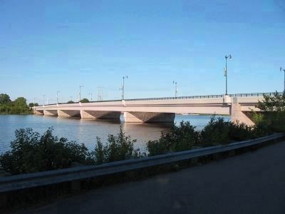
This highway bridge continues to divide industrial and residential Marinette; downriver, foundries, factories and shipyards have replaced sawmills; upriver, impressive homes of lumbermen's families remain on Marinette's Riverside Avenue.
The Menominee River continues to be a vital waterway. Its source is only 12 miles from Lake Superior. The Menominee is formed by the confluence of the Brule and Michigamme Rivers a little over 100 miles upstream. Before the Menominee reaches this island it falls nearly 700 feet. Ten hydroelectric dams (two in Marinette) harness its power and create reservoirs, and four papermills draw on its water in converting wood into a variety of household necessities. Many of its tributaries and parts of the Menominee remain wild and continue to flow untamed.
Topics. This historical marker is listed in these topic lists: Industry & Commerce • Native Americans • Settlements & Settlers • Waterways & Vessels. A significant historical month for this entry is July 1862.
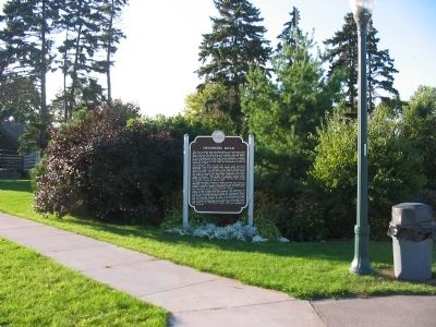
Location. 45° 6.119′ N, 87° 37.757′ W. Marker is in Marinette, Wisconsin, in Marinette County. Marker can be reached from Bridge Street (U.S. 41) 0.1 miles north of Riverside Avenue (State Highway 180), on the left when traveling north. Marker is in Stephenson Island Park. Touch for map. Marker is in this post office area: Marinette WI 54143, United States of America. Touch for directions.
Other nearby markers. At least 8 other markers are within walking distance of this marker. 10,000 Board Feet of Logs (within shouting distance of this marker); Evancheck Cabin (about 300 feet away, measured in a direct line); John Hubley (about 600 feet away); Isaac Stephenson (approx. 0.2 miles away); Queen Marinette (approx. 0.3 miles away); Bay de Nocquet Trail (approx. 0.4 miles away in Michigan); Milwaukee Road Depot (approx. half a mile away); Menominee Area (approx. 0.6 miles away in Michigan). Touch for a list and map of all markers in Marinette.
Also see . . .
1. Menominee River. "The name of the river comes from the name of an Algonquian language term meaning "wild rice," or "in the place of wild rice," named for the Menominee tribe who lived in the area and subsisted on the plant." (Submitted on February 8, 2009.)
2. Marinette, Wisconsin. The name "Marinette" is said to have come from the name of an early fur-trader's common-law wife, Marie Antoinette Chevalier, a French and Native American woman who ran a trading post located near the mouth of the Menominee River. (Submitted on February 8, 2009.)
3. Isaac Stephenson. Isaac Stephenson was an American politician of the Republican Party who represented Wisconsin as both a United States Representative and a United States Senator. Although Stephenson suffered heavy losses in the Peshtigo Fire of 1871, he recouped, and soon was one of the wealthiest lumbermen in the Great Lakes area. (Submitted on February 8, 2009.)
Credits. This page was last revised on May 18, 2019. It was originally submitted on February 8, 2009, by Keith L of Wisconsin Rapids, Wisconsin. This page has been viewed 3,853 times since then and 55 times this year. Photos: 1, 2, 3, 4, 5. submitted on February 8, 2009, by Keith L of Wisconsin Rapids, Wisconsin. • Kevin W. was the editor who published this page.
