Near Boonsboro in Washington County, Maryland — The American Northeast (Mid-Atlantic)
Turner's Pass Tablet T. P. 3
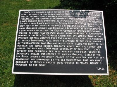
Hill's five brigades were encamped at and around Boonsboro to prevent the escape of the Union forces at Harper's Ferry, through Pleasant Valley. Informed that two Union brigades were approaching Turner's Pass, Hill, on the evening of September 13, ordered Colquitt's and Garland's Brigades from Boonsboro, to dispute the passage of the mountain. Colquitt, with Lane's battery of Georgia Artillery, moved nearly to the east foot of the mountain and formed north of this road. During the night Garland's brigade and Bondurant's Alabama battery took position a few yards east of this. The Fourth Georgia of Ripley's brigade was ordered to guard Hamburg Pass, nearly three miles north. Early on the morning of the 14th Col. T.L. Rosser, with the 5th Virginia Cavalry and Pelham's Battery occupied Fox's Gap one mile south of this, traversed by the old Sharpsburg Road. Upon the approach of the Union advance by the Sharpsburg Road, Garland moved South along the crest of the mountain and joined Rosser. Colquitt moved back and formed line across the road about 700 yards southeast of this point. Lane's battery took the position a few feet north of this point. George B. Anderson's brigade was ordered to support Garland. Later in the day, Rodes occupied prominent peaks of the mountain north of this, commanding the approaches by the Old Hagerstown Road, and three regiments of Ripley's Brigade were ordered to follow George B. Anderson to the right.
Erected by Antietam Battlefield Board. (Marker Number T. P. 3.)
Topics and series. This historical marker is listed in this topic list: War, US Civil. In addition, it is included in the Antietam Campaign War Department Markers series list. A significant historical date for this entry is September 13, 1972.
Location. 39° 29.082′ N, 77° 37.176′ W. Marker is near Boonsboro, Maryland, in Washington County. Marker is at the intersection of Old National Road (Alternate U.S. 40) and Washington Monument Road, on the right when traveling west on Old National Road. Located at a pull off from the Washington Monument Road, along side the Old National Road. Across the highway from the Old South Mountain Inn. Very close to the Frederick and Washington County line. The Appalachian Trail passes a few feet from the marker. Touch for map. Marker is at or near this postal address: 6127 Old National Pike, Boonsboro MD 21713, United States of America. Touch for directions.
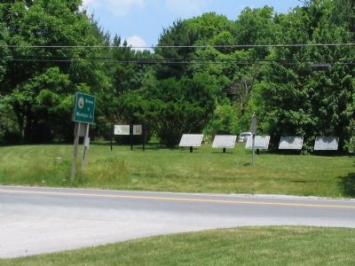
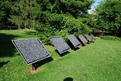
Other nearby markers. At least 10 other markers are within walking distance of this marker. Turner's Pass Tablet T. P. 1 (here, next to this marker); Turner's Pass Tablet T. P. 2 (here, next to this marker); Turner's Pass Tablet T. P. 4 (here, next to this marker); Turner's Pass Tablet T. P. 5 (here, next to this marker); Turner's Pass Tablet T. P. 6 (here, next to this marker); South Mountain Summit (within shouting distance of this marker); John Collins (within shouting distance of this marker); 19th Century Backpacker (within shouting distance of this marker); Battle at South Mountain (within shouting distance of this marker); 1862 Antietam Campaign (within shouting distance of this marker). Touch for a list and map of all markers in Boonsboro.
More about this marker. The title of this tablet is based on references in Battle of Antietam: The Official History by the Antietam Battlefield Board by George R. Large and Joe A. Swisher. None of the markers at Turner's Pass (or Gap) have a header or title.
Related markers. Click here for a list of markers that are related to this marker. To better understand the relationship, study each marker in the order shown.
Also see . . .
1. Remembering Our Boys: The Historical Tablets at Antietam National Battlefield. Antietam on the Webs entry (Submitted on March 26, 2022, by Larry Gertner of New York, New York.)
2. Following the Antietam Campaign with Maps. Antietam on the Web entry (Submitted on March 26, 2022, by Larry Gertner of New York, New York.)
Credits. This page was last revised on March 26, 2022. It was originally submitted on July 9, 2007, by Craig Swain of Leesburg, Virginia. This page has been viewed 2,146 times since then and 5 times this year. Photos: 1, 2. submitted on July 9, 2007, by Craig Swain of Leesburg, Virginia. 3. submitted on August 9, 2015, by Brandon Fletcher of Chattanooga, Tennessee. • J. J. Prats was the editor who published this page.


