Lawtonville in Hampton County, South Carolina — The American South (South Atlantic)
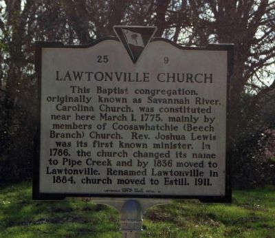
Lawtonville Church
Erected 1991 by Lawtonville Baptist Church, Estill S.C. (Marker Number 25-9.)
Topics. This historical marker is listed in these topic lists: Churches & Religion • Landmarks. A significant historical month for this entry is March 1619.
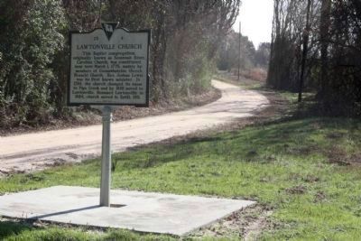
Location. 32° 42.923′ N, 81° 21.4′ W. Marker is in Lawtonville, South Carolina, in Hampton County. Marker is on Augusta Stagecoach Road (State Highway 25-20), on the left when traveling north. Beyond the paved road, approximately one third of a mile along the dirt road (Augusta Stagecoach Road). Touch for map. Marker is in this post office area: Estill SC 29918, United States of America. Touch for directions.
Other nearby markers. At least 8 other markers are within 11 miles of this marker, measured as the crow flies. Morrison Academy (approx. 5˝ miles away); Lucile Ellerbe Godbold (approx. 7.3 miles away); Estill Presbyterian Church (approx. 7.3 miles away); a different marker also named Lawtonville Church (approx. 7.4 miles away); Washington Slept Here (approx. 8 miles away in Georgia); Battle of Brier Creek - Mar. 3, 1779 (approx. 9.1 miles away in Georgia); General Samuel Elbert (approx. 9.1 miles away in Georgia); Beech Branch Baptist Church (approx. 10.8 miles away).
Related marker. Click here for another marker that is related to this marker. A marker at Lawtonville Church's current location.
Photographed By Mike Stroud, December 28, 2008
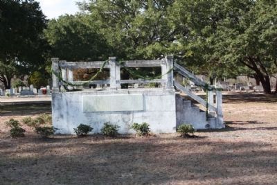
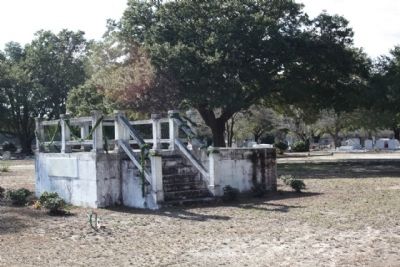
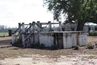
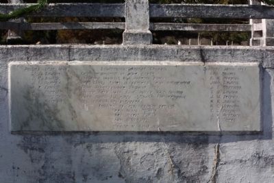
3. Remains of the Lawtonville Baptist Church at Lawtonville (Estill,) SC..2nd site
First Organized at Pipe Creek
Beaufort district, by dissenters who emigrated
from Somersetshire England. 1775.
Who moved here in 1852. four acres land having
been given by Amos Johnson for religious
and educational purposes.
Pastors of the ante- bellum period
Rev. Isaac Nickois.
Rev. Joseph Furse.
Rev. Hotchkiss.
Moved to Estill 1911.
Deacons since 1865.
Geo. Rhodes.
E.H. Peeples.
John Lawton.
J.T. Morrison.
T.D. Lawton.
J.W. Peeples.
N.H. Johnston.
N.C. Johnston.
C.L. Peeples.
J.V. Morrison.
G.B. Clarke."
Photographed By Mike Stroud, 2009
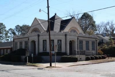
7. Lawtonville Church today, its third and present location, in Estill, SC
Coordinates: 32.755028,-81.238301, Fourth St. and
Lawton Ave
Click for more information.
Click for more information.
Credits. This page was last revised on June 16, 2016. It was originally submitted on February 11, 2009, by Mike Stroud of Bluffton, South Carolina. This page has been viewed 1,585 times since then and 43 times this year. Photos: 1, 2, 3, 4, 5, 6, 7. submitted on February 11, 2009, by Mike Stroud of Bluffton, South Carolina. • Kevin W. was the editor who published this page.
