Near Chester in Chesterfield County, Virginia — The American South (Mid-Atlantic)
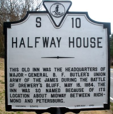
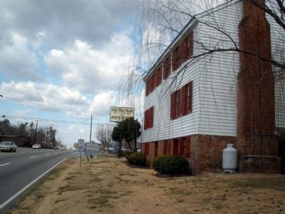
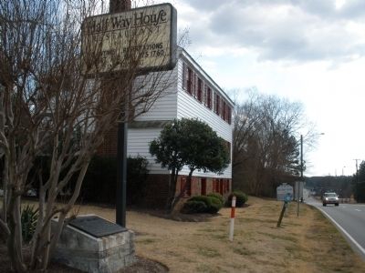
Halfway House
Erected 1951 by Virginia State Library. (Marker Number S-10.)
Topics and series. This historical marker is listed in this topic list: War, US Civil. In addition, it is included in the Virginia Department of Historic Resources (DHR) series list. A significant historical date for this entry is May 16, 1864.
Location. 37° 23.128′ N, 77° 25.471′ W. Marker is near Chester, Virginia, in Chesterfield County. Marker is at the intersection of Jefferson Davis Highway (U.S. 1) and Wonderview Drive, on the right when traveling north on Jefferson Davis Highway. Touch for map. Marker is at or near this postal address: 10301 Jefferson Davis Highway, Richmond VA 23237, United States of America. Touch for directions.
Other nearby markers. At least 8 other markers are within 2 miles of this marker, measured as the crow flies. The Half-Way House (a few steps from this marker); a different marker also named Half-Way House (within shouting distance of this marker); Into the "Bottle" (approx. 0.4 miles away); Proctor's Creek Fight (approx. 0.4 miles away); Second Battle of Drewry's Bluff (approx. 0.8 miles away); Drewry’s Bluff Battlefield (approx. 0.8 miles away); Osbornes (approx. 1.2 miles away); Farrar's Island (approx. 1.2 miles away). Touch for a list and map of all markers in Chester.
Also see . . .
1. CWSAC Battle Summary. Proctor's Creek (Submitted on February 11, 2009, by Bernard Fisher of Richmond, Virginia.)
2. Half-Way House Restaurant. (Submitted on February 11, 2009, by Bernard Fisher of Richmond, Virginia.)
Credits. This page was last revised on June 16, 2016. It was originally submitted on February 11, 2009, by Bernard Fisher of Richmond, Virginia. This page has been viewed 2,016 times since then and 69 times this year. Photos: 1, 2, 3. submitted on February 11, 2009, by Bernard Fisher of Richmond, Virginia. • Craig Swain was the editor who published this page.


