South Newport in Liberty County, Georgia — The American South (South Atlantic)
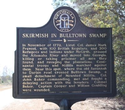
Skirmish in Bulltown Swamp
Erected 1957 by Georgia Historical Commission. (Marker Number 089-16.)
Topics and series. This historical marker is listed in this topic list: War, US Revolutionary. In addition, it is included in the Georgia Historical Society series list. A significant historical month for this entry is November 1778.
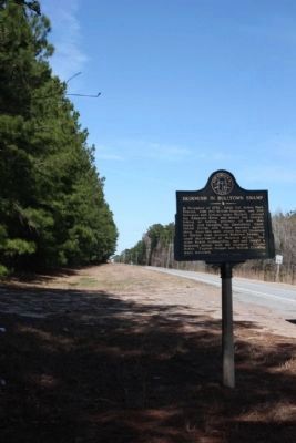
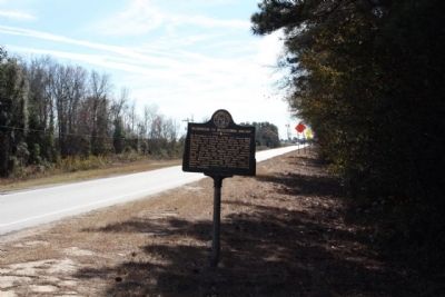
Location. 31° 39.508′ N, 81° 23.802′ W. Marker is in South Newport, Georgia, in Liberty County. Marker is on South Coastal Highway (U.S. 17) 0.2 miles north of Interstate 95, on the left when traveling north. Touch for map. Marker is in this post office area: Riceboro GA 31323, United States of America. Touch for directions.
Other nearby markers. At least 8 other markers are within 7 miles of this marker, measured as the crow flies. Confederate Post in 1864 (approx. 1.3 miles away); South Newport Baptist Church (approx. 1˝ miles away); Jonesville (approx. 1.7 miles away); William Bartram Trail (approx. 2.8 miles away); The McIntosh Family Of McIntosh County (approx. 2.8 miles away); LeConte Botanical Gardens (approx. 3.2 miles away); Woodmanston Plantation (approx. 6.3 miles away); a different marker also named William Bartram Trail (approx. 6.3 miles away). Touch for a list and map of all markers in South Newport.
Also see . . . Revolutionary War Raids & Skirmishes in 1778. Scroll down to November 26, 1778 for information about skirmishes inthe Bulltown Swamp area. (Submitted on February 13, 2009.)
Credits. This page was last revised on June 16, 2016. It was originally submitted on February 13, 2009, by Mike Stroud of Bluffton, South Carolina. This page has been viewed 1,795 times since then and 97 times this year. Photos: 1, 2, 3. submitted on February 13, 2009, by Mike Stroud of Bluffton, South Carolina. • Kevin W. was the editor who published this page.


