Near Chester in Chesterfield County, Virginia — The American South (Mid-Atlantic)
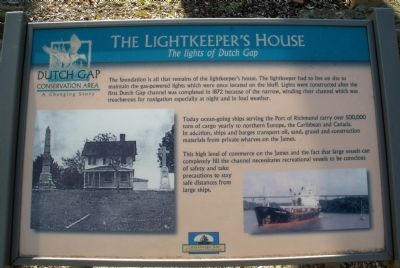
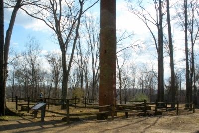
The Lightkeeper’s House
The lights of Dutch Gap
Today ocean-going ships serving the Port of Richmond carry over 500,000 tons of cargo yearly to northern Europe, the Caribbean and Canada. In addition, ships and barges transport oil, sand, gravel and construction materials from private wharves on the James.
This high level of commerce on the James and the fact that large vessels can completely fill the channel necessitates recreational vessels to be conscious of safety and take precautions to stay safe distances from large ships.
Erected by Chesapeake Bay Gateways Network.
Topics. This historical marker is listed in this topic list: Waterways & Vessels. A significant historical year for this entry is 1872.
Location. 37° 22.584′ N, 77° 21.6′ W. Marker is near Chester, Virginia, in Chesterfield County. Marker can be reached from Henricus Park Road, 1.3 miles east of Coxendale Road. The marker is located in Henricus Historical Park 300 yards north of the parking lot. Touch for map. Marker is at or near this postal address: 251 Henricus Park Road, Chester VA 23836, United States of America. Touch for directions.
Other nearby markers. At least 8 other markers are within walking distance of this marker. The Church of Henricopolis (a few steps from this marker); Henricopolis (a few steps from this marker); Henricus Historical Park (within shouting distance of this marker); John Smith Explores the Chesapeake (within shouting distance of this marker); Dutch Gap Canal (within shouting distance of this marker); USCTs At Dutch Gap (within shouting distance of this marker); The Bermuda Hundred Campaign (within shouting distance of this marker); Changes Over Time (within shouting distance of this marker). Touch for a list and map of all markers in Chester.
Also see . . .
1. Henricus Historical Park. (Submitted on February 15, 2009, by Bernard Fisher of Richmond, Virginia.)
2. Chesapeake Bay Gateways Network. (Submitted on February 15, 2009, by Bernard Fisher of Richmond, Virginia.)
3. National Park Service. Chesapeake Bay Gateways Network (Submitted on February 15, 2009, by Bernard Fisher of Richmond, Virginia.)
4. Dutch Gap Conservation Area. (Submitted on February 15, 2009, by Bernard Fisher of Richmond, Virginia.)
Credits. This page was last revised on June 16, 2016. It was originally submitted on February 15, 2009, by Bernard Fisher of Richmond, Virginia. This page has been viewed 903 times since then and 15 times this year. Photos: 1, 2. submitted on February 15, 2009, by Bernard Fisher of Richmond, Virginia. • Craig Swain was the editor who published this page.

