Willington in Tolland County, Connecticut — The American Northeast (New England)
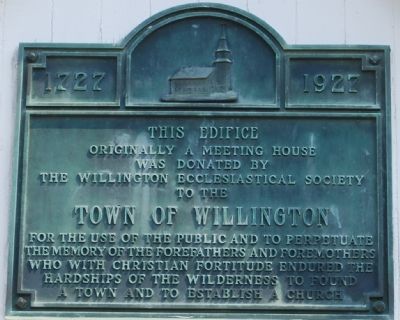
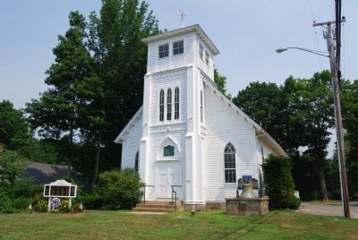
This Edifice
Erected 1927 by Wilington Ecclesiastical Society.
Topics. This historical marker is listed in these topic lists: Notable Buildings • Settlements & Settlers. A significant historical year for this entry is 1727.
Location. 41° 52.565′ N, 72° 15.814′ W. Marker is in Willington, Connecticut, in Tolland County. Marker can be reached from the intersection of Connecticut Route 74 and Connecticut Route 320. Touch for map. Marker is in this post office area: Willington CT 06279, United States of America. Touch for directions.
Other nearby markers. At least 8 other markers are within 5 miles of this marker, measured as the crow flies. Town of Willington, Connecticut (within shouting distance of this marker); Willington (about 300 feet away, measured in a direct line); The Federated Church of Willington (about 400 feet away); Baptist Church of Willington (about 400 feet away); a different marker also named Willington (approx. 2.2 miles away); a different marker also named Willington (approx. 2.4 miles away); Historic Horsebarn Hill (approx. 4.4 miles away); A Familiar Vista (approx. 4.4 miles away). Touch for a list and map of all markers in Willington.

Photographed By Dawn Bowen, July 10, 2007
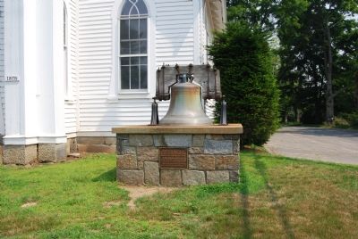
4. Bell Tablet
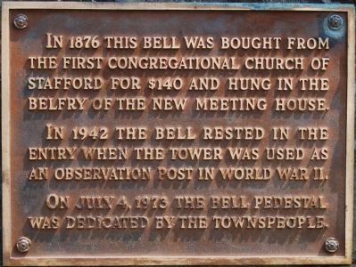
In 1876 this bell was bought from the First Congregational Church of Stafford for $140 and hung in the belfry of the new meeting house.
In 1942 the bell rested in the entry when the tower was used as an observation post in World War II.
On July 4, 1973 the bell pedestal was dedicated by the townspeople.
Credits. This page was last revised on June 16, 2016. It was originally submitted on July 11, 2007, by Dawn Bowen of Fredericksburg, Virginia. This page has been viewed 1,464 times since then and 7 times this year. Photos: 1, 2, 3, 4. submitted on July 11, 2007, by Dawn Bowen of Fredericksburg, Virginia. • J. J. Prats was the editor who published this page.


