Fredericksburg, Virginia — The American South (Mid-Atlantic)
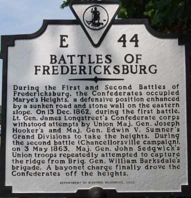
Battles of Fredericksburg
Erected 2000 by Department of Historic Resources. (Marker Number E-44.)
Topics and series. This historical marker is listed in this topic list: War, US Civil. In addition, it is included in the Virginia Department of Historic Resources (DHR) series list. A significant historical date for this entry is May 3, 1863.
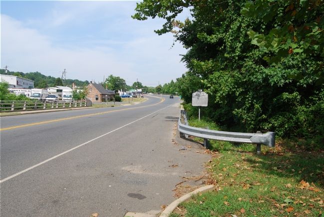
Location. 38° 17.468′ N, 77° 28.201′ W. Marker is in Fredericksburg, Virginia. Marker is on Lafayette Boulevard (Business U.S. 1) 0.2 miles north of Blue & Gray Parkway (Virginia Route 3), on the right when traveling north. Touch for map. Marker is in this post office area: Fredericksburg VA 22401, United States of America. Touch for directions.
Other nearby markers. At least 8 other markers are within walking distance of this marker. Parker's Battery (about 400 feet away, measured in a direct line); The Second Battle of Fredericksburg (about 500 feet away); Andrew Atkinson Humphreys (about 700 feet away); Col. Joseph A. Moesch (about 700 feet away); Decoration Day (about 800 feet away); 127th Regiment Pennsylvania Volunteer Infantry (approx. 0.2 miles away); The Fifth Corps, Army of the Potomac (approx. 0.2 miles away); Fredericksburg National Cemetery (approx. 0.2 miles away). Touch for a list and map of all markers in Fredericksburg.
More about this marker. This marker replaces a marker dating from the late 1920s or early 1930s with the same name and number which read, “Here the highway crosses the line held by the Confederate infantry at Mary’s Heights in the battles of December 13, 1862, and May 3, 1863. —Ed.
Credits. This page was last revised on February 2, 2023. It was originally submitted on July 14, 2007, by Dawn Bowen of Fredericksburg, Virginia. This page has been viewed 2,764 times since then and 21 times this year. Photos: 1, 2. submitted on July 14, 2007, by Dawn Bowen of Fredericksburg, Virginia. 3. submitted on July 5, 2008, by Craig Swain of Leesburg, Virginia. • J. J. Prats was the editor who published this page.


