Near Fredericksburg in Spotsylvania County, Virginia — The American South (Mid-Atlantic)
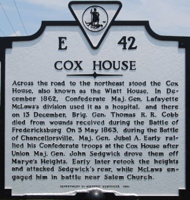
Cox House
Erected 1995 by Department of Historic Resources. (Marker Number E-42.)
Topics and series. This historical marker is listed in this topic list: War, US Civil. In addition, it is included in the Virginia Department of Historic Resources (DHR) series list. A significant historical date for this entry is May 3, 1863.
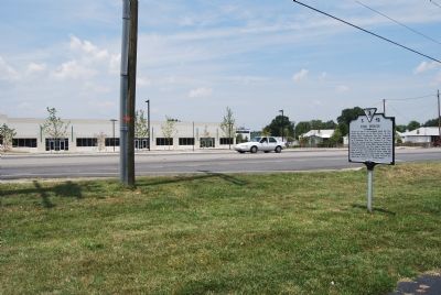
Location. 38° 15.694′ N, 77° 29.542′ W. Marker is near Fredericksburg, Virginia, in Spotsylvania County. Marker is on Lafayette Boulevard (Business U.S. 1) half a mile north of Jefferson Davis Highway (U.S. 1), on the right when traveling north. Touch for map. Marker is at or near this postal address: 4017 Lafayette Blvd, Fredericksburg VA 22408, United States of America. Touch for directions.
Other nearby markers. At least 10 other markers are within 2 miles of this marker, measured as the crow flies. The Chancellorsville Campaign (here, next to this marker); Longstreet’s Winter Headquarters (a few steps from this marker); Stuart (approx. 0.6 miles away); Start of Sheridan's Raid (approx. 0.6 miles away); Lee’s Head Quarters (approx. 1.1 miles away); Fredericksburg Campaign (approx. 1.3 miles away); Virginia Central Railway Trail (approx. 1.3 miles away); a different marker also named Fredericksburg Campaign (approx. 1.4 miles away); The Railway, With Tracks and Without (approx. 1.4 miles away); Reestablishing a Travel Way (approx. 1.4 miles away). Touch for a list and map of all markers in Fredericksburg.
More about this marker. This marker replaced a marker with this same number but titled “Early’s Line of Battle” that was erected in the late 1920s or early 1930s. It read, “Here Jubal A. Early formed line of battle across the road on the afternoon of May 3, 1863, after being driven from Fredericksburg by Sedgwick.” -Ed.
Related markers. Click here for a list of markers that are related to this marker. Cobb's mortal wounding and the house he died in.
Credits. This page was last revised on February 2, 2023. It was originally submitted on July 15, 2007, by Dawn Bowen of Fredericksburg, Virginia. This page has been viewed 1,579 times since then and 36 times this year. Photos: 1, 2. submitted on July 15, 2007, by Dawn Bowen of Fredericksburg, Virginia. • J. J. Prats was the editor who published this page.

