Piqua in Miami County, Ohio — The American Midwest (Great Lakes)
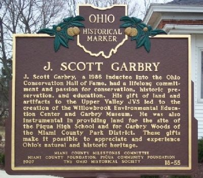
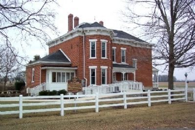
J. Scott Garbry
Erected 2007 by Miami County Milestones Committee, Miami County Foundation, Piqua Community Foundation, and The Ohio Historical Society. (Marker Number 18-55.)
Topics and series. This historical marker is listed in these topic lists: Education • Environment. In addition, it is included in the Ohio Historical Society / The Ohio History Connection series list. A significant historical year for this entry is 1986.
Location. 40° 9.017′ N, 84° 11.881′ W. Marker is in Piqua, Ohio, in Miami County. Marker is at the intersection of U.S. 36 and Troy-Sidney Road (County Highway 25A), on the left when traveling east on U.S. 36. Touch for map. Marker is in this post office area: Piqua OH 45356, United States of America. Touch for directions.
Other nearby markers. At least 8 other markers are within 3 miles of this marker , measured as the crow flies. Rural Electrification (approx. ¼ mile away); Vice Admiral Stephen Clegg Rowan (approx. 2.1 miles away); Randolph Settlement (approx. 2.1 miles away); The Village of Huntersville (approx. 2.1 miles away); Lock Nine (approx. 2.1 miles away); Lock Nine Riverfront Park (approx. 2.1 miles away); The 1913 Flood (approx. 2.2 miles away); Capt. Don Gentile (approx. 2.2 miles away). Touch for a list and map of all markers in Piqua.
Credits. This page was last revised on December 2, 2019. It was originally submitted on March 18, 2009, by William Fischer, Jr. of Scranton, Pennsylvania. This page has been viewed 1,446 times since then and 36 times this year. Photos: 1, 2. submitted on March 18, 2009, by William Fischer, Jr. of Scranton, Pennsylvania. • Kevin W. was the editor who published this page.

