Cumberland Township near Gettysburg in Adams County, Pennsylvania — The American Northeast (Mid-Atlantic)
First Brigade
First Division - Eleventh Corps
— Army of the Potomac —
Inscription.
Eleventh Corps First Division
First Brigade
Col. Leopold Von Gilsa
41st. (9 cos.) 54th. 68th. New York
153d. Pennsylvania Infantry
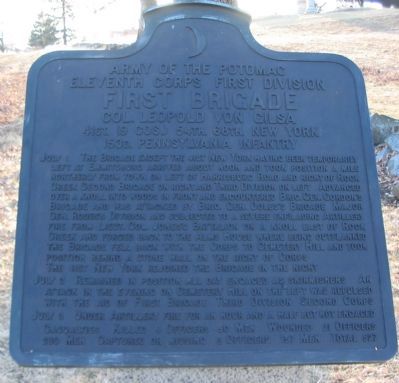
July 1 The Brigade except the 41st New York having been temporarily left at Emmitsburg arrived about noon and took position a mile northerly from town on left of Harrisburg Road and right of Rock Creek Second Brigade on right and Third Division on left. Advanced over a knoll into woods in front and encountered Brig. Gen. Gordon's Brigade and was attacked by Brig. Gen. Doles's Brigade Major Gen. Rodes's Division and subjected to a severe enfilading Artillery fire from Lieut. Col. Jones's Battalion on a knoll east of Rock Creek and forced back to the Alms House where being outflanked the Brigade fell back with the Corps to Cemetery Hill and took position behind a stone wall on the right of corps.
The 41st New York rejoined the Brigade in the night.
July 2 Remained in position all day engaged as skirmishers. An attack in the evening on Cemetery Hill on the left was repulsed with the aid of First Brigade Third Division Second Corps.
July 3 Under Artillery fire for an hour and a half but not engaged.
Casualties. Killed 4 officers 50 men. Wounded 21 officers 289 men. Captured or missing 6 officers 157 men. Total 527.
Erected 1912 by Gettysburg National Military Park Commission.
Topics. This memorial is listed in this topic list: War, US Civil. A significant historical date for this entry is July 1, 1863.
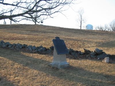
Location. 39° 49.297′ N, 77° 13.645′ W. Marker is near Gettysburg, Pennsylvania, in Adams County. It is in Cumberland Township. Memorial is on Wainwright Avenue, on the left when traveling north. Located on East Cemetery Hill in Gettysburg National Military Park. Touch for map. Marker is in this post office area: Gettysburg PA 17325, United States of America. Touch for directions.
Other nearby markers. At least 8 other markers are within walking distance of this marker. 153rd Regiment Pennsylvania Volunteers (a few steps from this marker); 68th New York Infantry (within shouting distance of this marker); 41st New York Infantry (within shouting distance of this marker); 7th West Virginia Infantry (within shouting distance of this marker); 54th New York Infantry (within shouting distance of this marker); Battery B, 1st Pennsylvania Light Artillery (about 400 feet away, measured in a direct line); Ricketts' Battery (about 400 feet away); Battery B, First Pennsylvania Light Artillery (about 400 feet away). Touch for a list and map of all markers in Gettysburg.
Photographed By Craig Swain
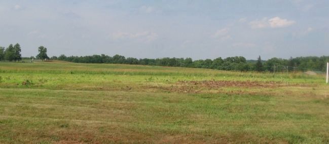
3. Von Gilsa's Brigade First Day Line
Looking northeast from the present day community college/extension office, which at the time of the battle was the site of the Almshouse. Von Gilsa's Brigade was first positioned on a line extending from Blocher's (Barlow's) Knoll to the Harrisburg Road. The knoll is on the left with monuments clearly visible. The Harrisburg Road runs on the right, with the view blocked by summer growth in this view. Confronted by Gordon's Confederate Brigade, von Gilsa's men held their fire until the enemy was at close range. As pressure mounted from Doles' Confederate Brigade attacking from the north also, von Gilsa's line broke. The remains of the command fell back through Gettysburg and reformed on East Cemetery Hill.
Photographed By Craig Swain, February 21, 2009
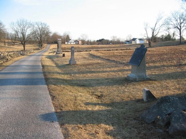
4. Von Gilsa's Brigade Tablet
The tablet, standing next to Wainwright Avenue, is in the center of the Brigade position on the afternoon of July 2. The 153d Pennsylvania and 41st New York stood to the right flank, with their monuments seen down the road from the tablet. In the foreground is a flank marker for the 14th Indiana, one of the regiments that reinforced the Brigade on the evening of July 2.
Photographed By Craig Swain, February 21, 2009
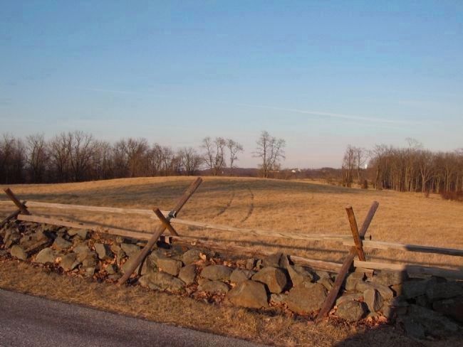
5. Front of Von Gilsa's Line on July 2
Looking from Wainwright Avenue to the east. This view illustrates one of the weaknesses of Von Gilsa's line. Although artillery on the crest of the hill had a wide view of the advancing Confederates, this rise blocked many of Von Gilsa's men from viewing Avery's North Carolinians until they were at close range.
Credits. This page was last revised on February 7, 2023. It was originally submitted on March 18, 2009, by Craig Swain of Leesburg, Virginia. This page has been viewed 823 times since then and 24 times this year. Photos: 1, 2. submitted on March 18, 2009, by Craig Swain of Leesburg, Virginia. 3. submitted on April 17, 2009, by Craig Swain of Leesburg, Virginia. 4, 5. submitted on March 18, 2009, by Craig Swain of Leesburg, Virginia.
