Near Fredericksburg in Spotsylvania County, Virginia — The American South (Mid-Atlantic)
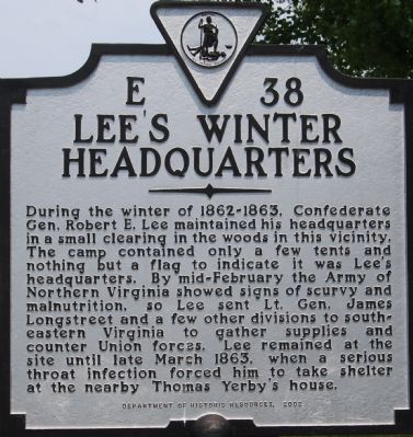
Lee’s Winter Headquarters
Erected 2002 by Department of Historic Resources. (Marker Number E-38.)
Topics and series. This historical marker is listed in this topic list: War, US Civil. In addition, it is included in the Virginia Department of Historic Resources (DHR) series list. A significant historical month for this entry is March 1863.
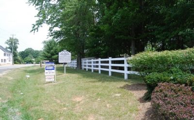
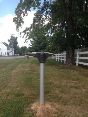
Location. Marker is missing. It was located near 38° 14.921′ N, 77° 28.743′ W. Marker was near Fredericksburg, Virginia, in Spotsylvania County. Marker was on Mine Road (County Route 636) 1.1 miles east of Jefferson Davis Highway (U.S. 1), on the right when traveling east. Touch for map. Marker was at or near this postal address: 10407 Norfolk Way, Fredericksburg VA 22408, United States of America. Touch for directions.
Other nearby markers. At least 10 other markers are within 2 miles of this location, measured as the crow flies. Lee’s Head Quarters (approx. 0.2 miles away); Fredericksburg Campaign (approx. 0.8 miles away); Start of Sheridan's Raid (approx. 1.1 miles away); Stuart (approx. 1.1 miles away); Bernard's Cabin Trail (approx. 1.1 miles away); Riverside Plantation: Mannsfield (approx. 1.1 miles away); Cox House (approx. 1.1 miles away); The Chancellorsville Campaign (approx. 1.1 miles away); Longstreet’s Winter Headquarters (approx. 1.2 miles away); Bernard's Cabins (approx. 1½ miles away). Touch for a list and map of all markers in Fredericksburg.
More about this marker. A marker with this same number entitled “Lee’s Headquarters” was erected in the late 1920s on Route 1 at the intersection of Mine Road. It read, “Lee’s headquarters in the winter of 1862–63 were a mile down this road.”
Related markers. Click here for a list of markers that are related to this marker. Confederate winter quarters around Fredericksburg by markers
Credits. This page was last revised on February 2, 2023. It was originally submitted on July 15, 2007, by Dawn Bowen of Fredericksburg, Virginia. This page has been viewed 1,826 times since then and 54 times this year. Photos: 1, 2. submitted on July 15, 2007, by Dawn Bowen of Fredericksburg, Virginia. 3. submitted on September 8, 2013. • J. J. Prats was the editor who published this page.


