Near Williamsburg in James City County, Virginia — The American South (Mid-Atlantic)
A Diverse Jamestown Household 1620-1640
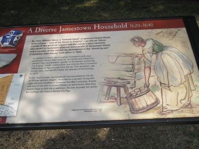
In addition to Peirce, the household included his wife Joan, praised by Captain John Smith as “an honest and industrious woman” who maintained a “garden at Jamestown containing 3 or 4 acres.” Smith noted further that Mistress Peirce harvested 100 bushels of figs annually from the lot. Their daughter, also named Joan, married John Rolfe, the widower of Pocahontas, in 1617.
In the 1625 muster, the household had expanded to include an African woman, Angelo, identified as a servant. Along with eight Africans residing on Governor Yeardley’s property, Angelo was one of the first recorded Africans at Jamestown. How long Angelo lived on this site is unknown. No one recorded her duties, but perhaps she helped harvest the figs.
Erected by Colonial National Historic Park.
Topics. This historical marker is listed in this topic list: Colonial Era. A significant historical year for this entry is 1624.
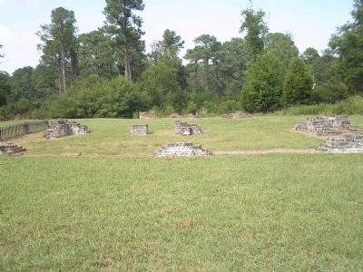
Location. 37° 12.454′ N, 76° 46.455′ W. Marker is near Williamsburg, Virginia, in James City County. Marker can be reached from Colonial Parkway, on the right when traveling west. Marker is in the "New Towne" section of the Historic Jamestown unit of Colonial National Historic Park. Touch for map. Marker is in this post office area: Williamsburg VA 23185, United States of America. Touch for directions.
Other nearby markers. At least 8 other markers are within walking distance of this marker. An Upper-Class Neighborhood 1630s-1699 (a few steps from this marker); May-Hartwell Site 1660-1699 (within shouting distance of this marker); A Remarkable Collection 1670-1700 (within shouting distance of this marker); The Ambler House (within shouting distance of this marker); Jackson Home 1620s (about 300 feet away, measured in a direct line); Ditch and Mound (about 300 feet away); Oyster Shells to Mortar (about 300 feet away); Fences and Livestock (about 400 feet away). Touch for a list and map of all markers in Williamsburg.
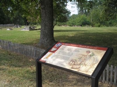
More about this marker. The right side of the marker contains a picture of an “English woman drawing water from one of Jamestown’s many wells, by Sidney King, ca. 1957.” The left side of the marker contains a map of Jamestown indicating the location of Peirce’s house, and pictures of artifacts excavated from the site, including pottery sherds.
Also see . . .
1. A Diverse Jamestown Household 1620 - 1640. Colonial National Historic Park from National Park Service website. (Submitted on March 26, 2009, by Bill Coughlin of Woodland Park, New Jersey.)
2. Historic Jamestowne. Historic Jamestowne is the site of the first permanent English settlement in America. The site is jointly administered by APVA Preservation Virginia and the National Park Service. (Submitted on March 26, 2009, by Bill Coughlin of Woodland Park, New Jersey.)
Credits. This page was last revised on June 16, 2016. It was originally submitted on March 26, 2009, by Bill Coughlin of Woodland Park, New Jersey. This page has been viewed 1,217 times since then and 13 times this year. Photos: 1, 2, 3. submitted on March 26, 2009, by Bill Coughlin of Woodland Park, New Jersey.


