Calvert in Cecil County, Maryland — The American Northeast (Mid-Atlantic)
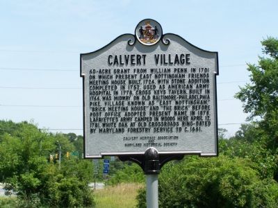
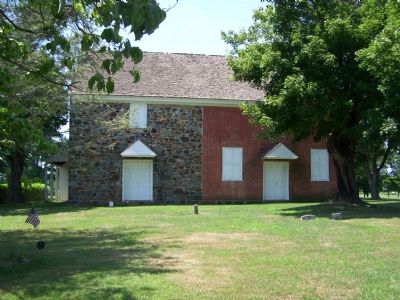
Calvert Village
Erected by Calvert Heritage Association and Maryland Historical Society.
Topics and series. This historical marker is listed in these topic lists: Churches & Religion • Colonial Era • Settlements & Settlers • War, US Revolutionary. In addition, it is included in the Quakerism series list. A significant historical month for this entry is April 1724.
Location. 39° 42.167′ N, 75° 58.869′ W. Marker is in Calvert, Maryland, in Cecil County. Marker is at the intersection of Telegraph Road (Maryland Route 273) and Rosebank Road, on the right when traveling east on Telegraph Road. Touch for map. Marker is in this post office area: Rising Sun MD 21911, United States of America. Touch for directions.
Other nearby markers. At least 8 other markers are within 3 miles of this marker, measured as the crow flies . Brick Meeting House (approx. 0.2 miles away); In Memory of the Unknown Soldiers (approx. 0.2 miles away); Historic East Nottingham Tanyard (approx. ¼ mile away); Brown's Water Corn and Grist Mill (approx. 1.1 miles away); Koi (approx. 1.1 miles away); Sheep (approx. 1.1 miles away); American Bison (approx. 1.1 miles away); The Nottingham Lots (approx. 3 miles away).
More about this marker.
should read 400-acre grant.
Credits. This page was last revised on February 15, 2020. It was originally submitted on July 18, 2007, by Bill Pfingsten of Bel Air, Maryland. This page has been viewed 3,693 times since then and 60 times this year. Last updated on February 15, 2020, by Carl Gordon Moore Jr. of North East, Maryland. Photos: 1, 2. submitted on July 18, 2007, by Bill Pfingsten of Bel Air, Maryland.

